Hierarchy
county
barony
civil parish
townland
townland
Baile an Churraigh
genitive: Bhaile an Churraigh
(Irish)
Ballincurry
(English)
Centrepoint
53.7871, -7.78257latitude, longitude
Irish Grid (with letter)
Computing...
Irish Grid (without letter)
Computing...
Irish Transverse Mercator (ITM)
Computing...
Archival records
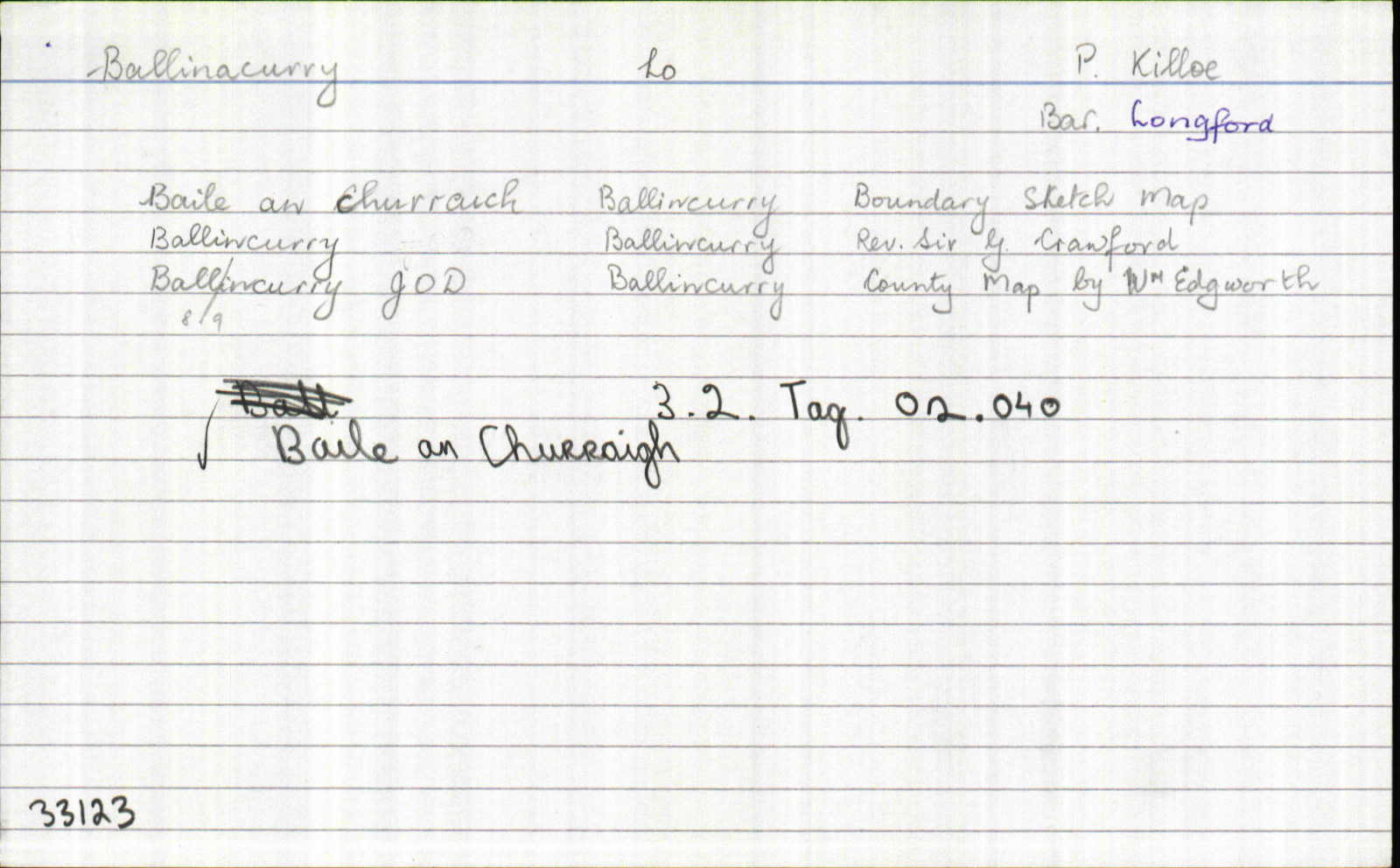
Historical references
| 1612 |
Ballincarran?
|
Inq. Lag. Leathanach: 3 Jac.1
|
| 1629 |
Moherduff [is cosúil go bhfuil an suíomh ceart]
|
|
| 1813 |
Ballincurry
|
|
| 1832 |
Ballincurry
|
|
| 1832 |
Ballincurry
|
|
| 1832 |
Ballincurry
|
|
| 1832 |
baile an churraigh, “town of the moor”
|
|
| 1832 |
baile an churraich
|
|
| 1832 |
...all this T.land is arable...
|
|
| 1908 |
Baile an Churraigh
|
MacGivney Leathanach: 33
|
| 1981 |
Baile an Churraigh, “Town of the Moor” – “It is possible that this is the Moreduff mentioned in the 1620 land grant and marked on the DS Map.” [Tá an Moreduff seo luaite le Monaduff agam féin..?]
|
Devaney Leathanach: 89
|
| 1982 |
Baile an Churraigh
|
|
| 2002 |
Baile an Churraigh
|
|
| 2007 |
balinˈkoriˑ
|
Please note: Some of the documentation from the archives of the Placenames Branch is available here. It indicates the range of research contributions undertaken by the Branch on this placename over the years. It may not constitute a complete record, and evidence may not be sequenced on the basis of validity. It is on this basis that this material is made available to the public.
Archival and research material provided on this site may be used, subject to acknowledgement. Issues regarding republication or other permissions or copyright should be addressed to logainm@dcu.ie.
Permanent link
https://www.logainm.ie/33123.aspxOpen data
Application programming interface (API)
Available under
Creative Commons Attribution 4.0 International (CC BY 4.0)
API key required to access data
Linked Logainm
Formats: RDF | RDF N3 | RDF JSON | RDF XML
Operated by Digital Repository of Ireland