Hierarchy
county
barony
civil parish
townland
Explanatory note
- English
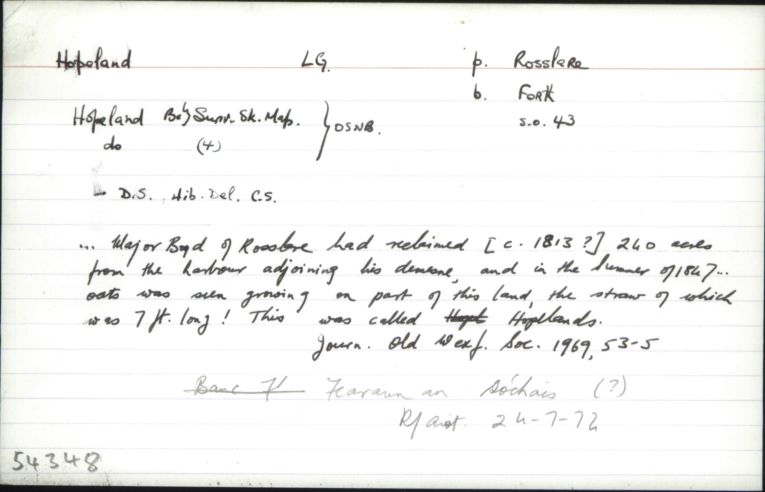
This English place-name refers to a portion of Wexford Harbour which was reclaimed in the early nineteenth century. The project ultimately failed and most of the area was once again inundated by the sea (see Furlong, 1996, pp.83–9).
The Irish form of the name is a translation.
[It has recently been claimed that the initial element of Hopeland is derived from Old Norse ‘Hóp(r), in this case a bay sheltered by Rosslare point – a long narrow extension of the wider sandspit’ [(details to be added)]. (ON hóp is explained by Zoëga as “a small land-locked bay or inlet (connected with the sea)”.) There is absolutely no evidence for this, however, and there is nothing to suggest the existence of a place-name such as Hope or Hope Island here prior to the reclamation of the land from the sea (see for example Chart XXIII on Mackenzie’s detailed Maritime Atlas of 1775). The name Hopeland would appear simply to refer to the aspiration that the area reclaimed would be bountiful. A parallel development is reflected in the townland name Hopefield (#53419) in the parish of Horetown, a late English creation that at some stage during the eighteenth century replaced the older name ‘Ballygortagh’, from Baile Gortach “barren, poor town(land)”, evidently after improvements had been made to the land there (see Townland Names of County Wexford pp.1040–41). Hopefield is surely situated far enough inland to discourage any speculation of derivation from a Viking sea-inlet, and the history of the name would appear to provide corroboration for the productive use of the Modern English word hope, in the same sense as in Hopeland, in the later toponymy of south Wexford. Compare derogatory field-names such as Hopeless Meadow, No Hope, etc., found in England (see A New Dictionary of English Field-Names (2018) p.241).]
Centrepoint
Archival records
Historical references
Please note: Some of the documentation from the archives of the Placenames Branch is available here. It indicates the range of research contributions undertaken by the Branch on this placename over the years. It may not constitute a complete record, and evidence may not be sequenced on the basis of validity. It is on this basis that this material is made available to the public.
Archival and research material provided on this site may be used, subject to acknowledgement. Issues regarding republication or other permissions or copyright should be addressed to logainm@dcu.ie.
Permanent link
https://www.logainm.ie/54348.aspxOpen data
Application programming interface (API)
Linked Logainm
Formats: RDF | RDF N3 | RDF JSON | RDF XML