Hierarchy
county
barony
civil parish
townland
subunits
townland
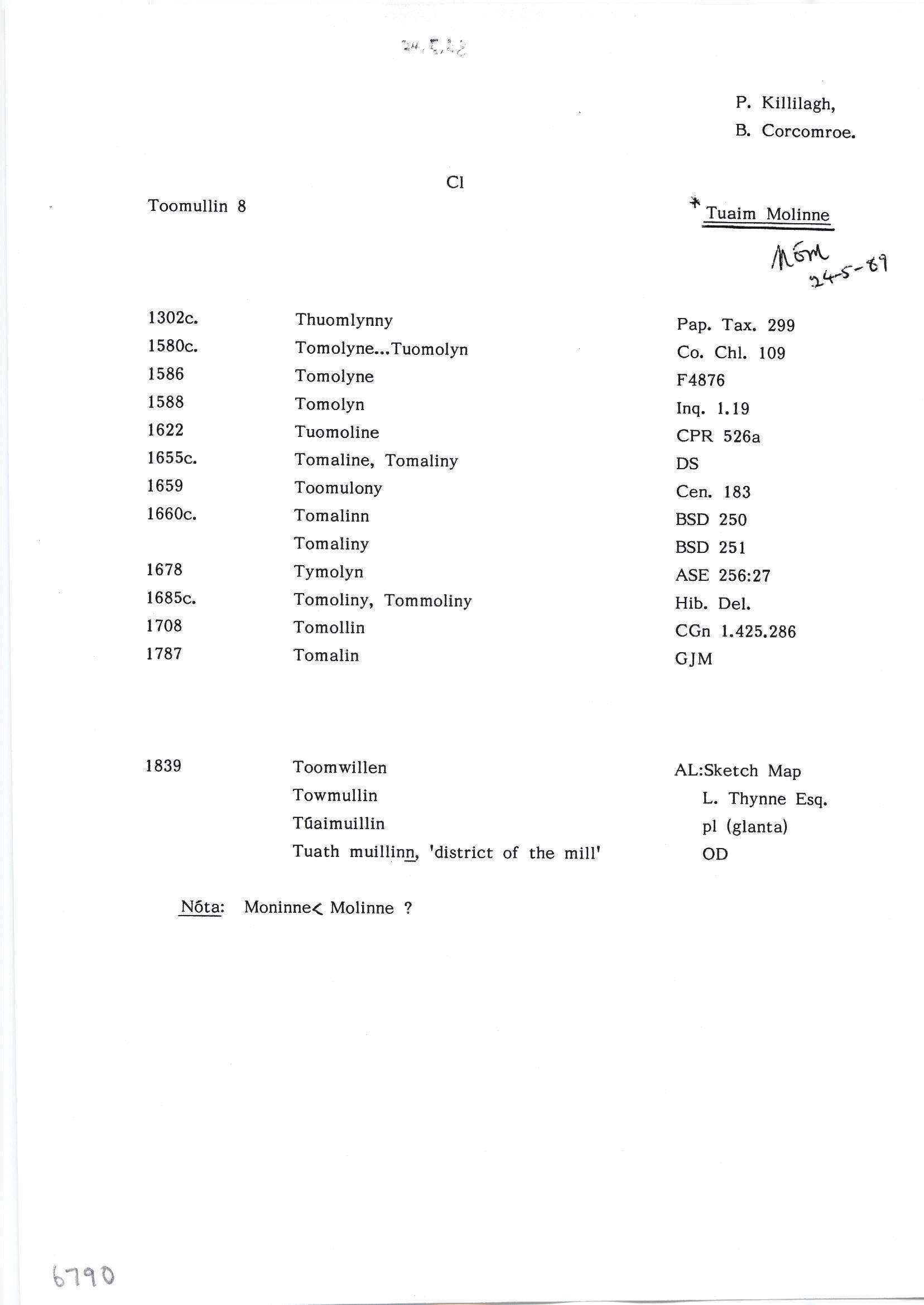
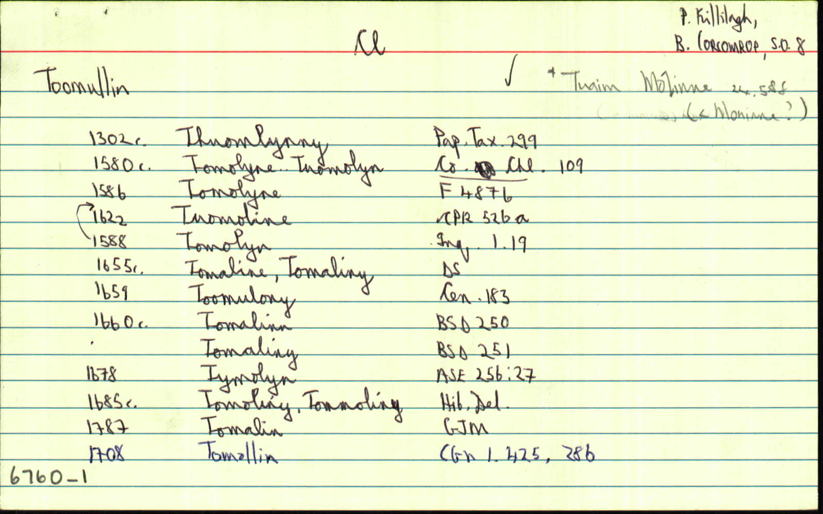
Toomullin
(English)
Centrepoint
53.0203, -9.36449latitude, longitude
Irish Grid (with letter)
Computing...
Irish Grid (without letter)
Computing...
Irish Transverse Mercator (ITM)
Computing...
Archival records
Historical references
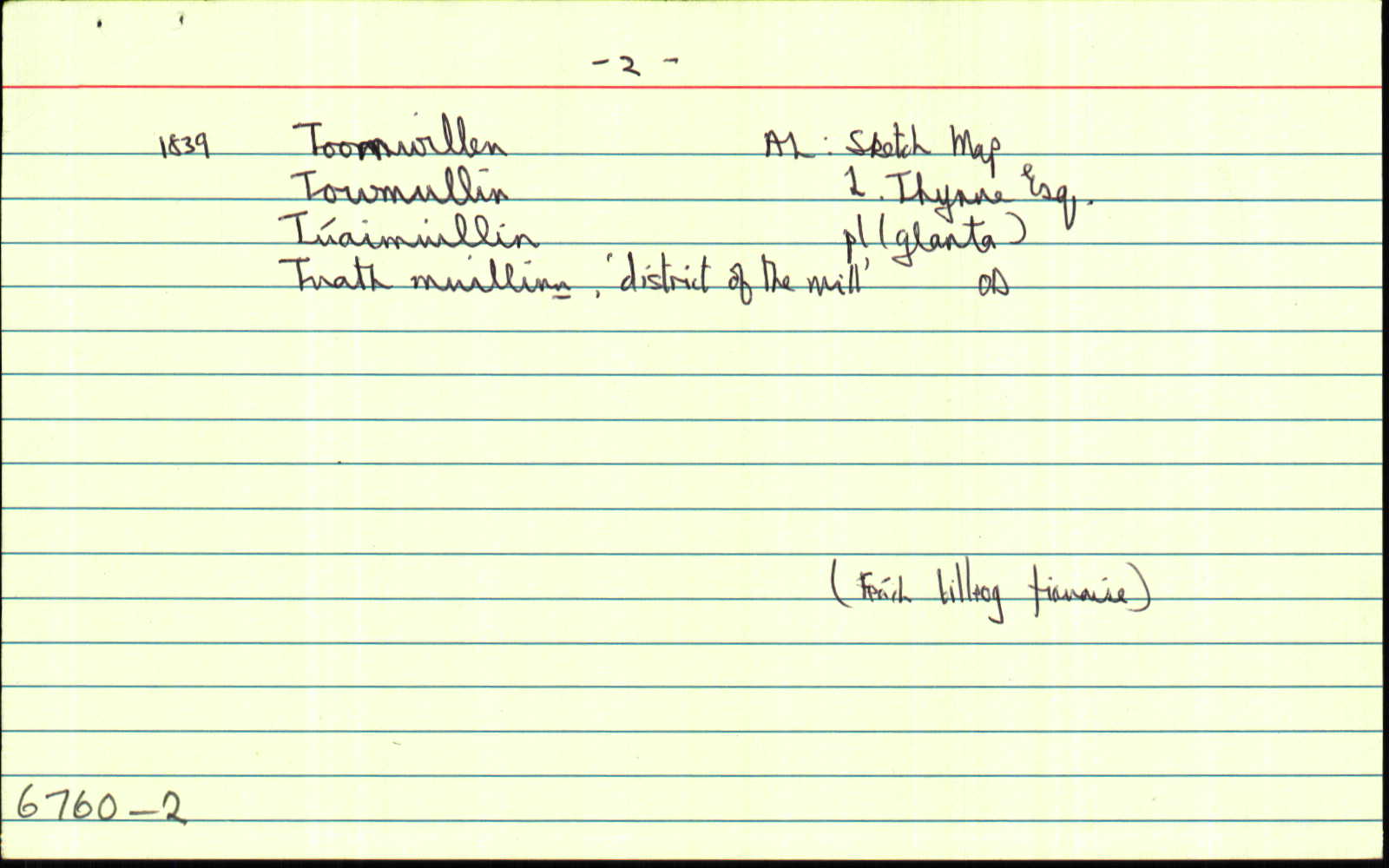
| 1839 |
Toomullin
|
OD:AL Leathanach: Cl066,89
|
| 1839 |
Toomwillen
|
BS:AL Leathanach: Cl066,89
|
| 1839 |
Towmullin
|
Thynne, L.:AL Leathanach: Cl066,89
|
| 1839 |
Tomolyn
|
Inq. Eliz. I:AL Leathanach: Cl066,89
|
| 1839 |
Tuath muillinn, ‘district of the mill’
"Tuaim" [pl scriosta];
|
OD:AL Leathanach: Cl066,89
|
| 1839 |
T[..] muillin
|
Glanta:AL Leathanach: Cl066,89
|
| 1839 |
[Toomullin]
"East of the townland there is a large caher or fort named Crucknaraha. Close to a large river south boundary stands the ruins of an old church named Templebeg, and close to it stands a spring well named St Brickens Well" [Desc. Rem.];
|
Desc. Rem.:AL Leathanach: Cl066,89
|
Please note: Some of the documentation from the archives of the Placenames Branch is available here. It indicates the range of research contributions undertaken by the Branch on this placename over the years. It may not constitute a complete record, and evidence may not be sequenced on the basis of validity. It is on this basis that this material is made available to the public.
Archival and research material provided on this site may be used, subject to acknowledgement. Issues regarding republication or other permissions or copyright should be addressed to logainm@dcu.ie.
Permanent link
https://www.logainm.ie/6760.aspxOpen data
Application programming interface (API)
Available under
Creative Commons Attribution 4.0 International (CC BY 4.0)
API key required to access data
Linked Logainm
Formats: RDF | RDF N3 | RDF JSON | RDF XML
Operated by Digital Repository of Ireland