Hierarchy
county
barony
civil parish
townland
subunits
townland
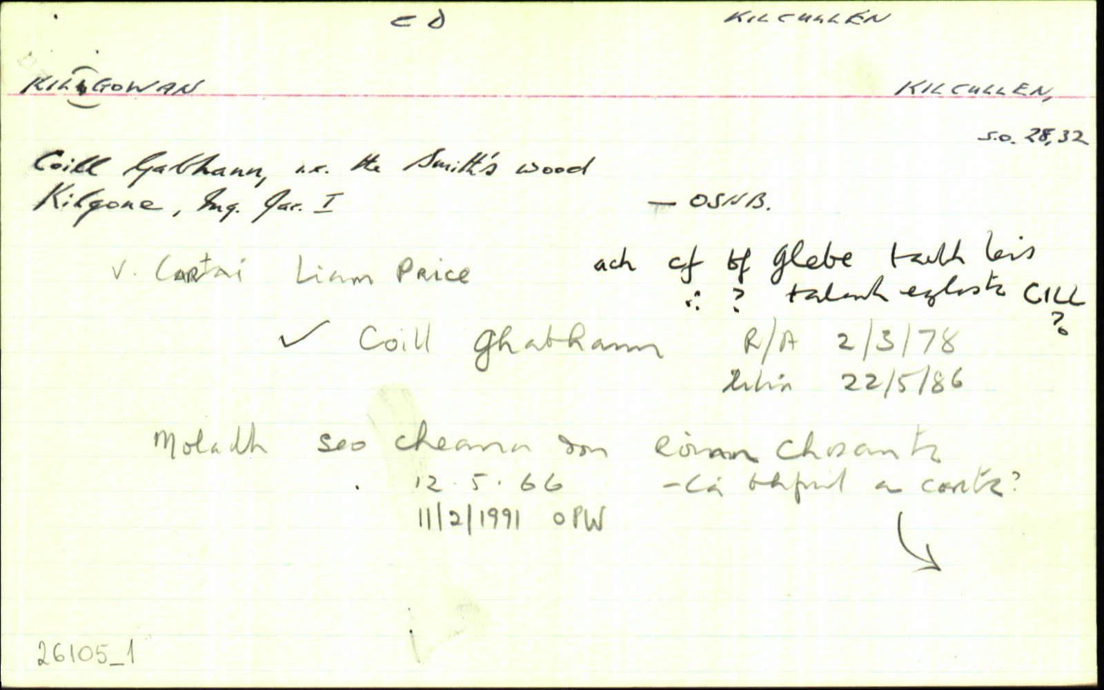
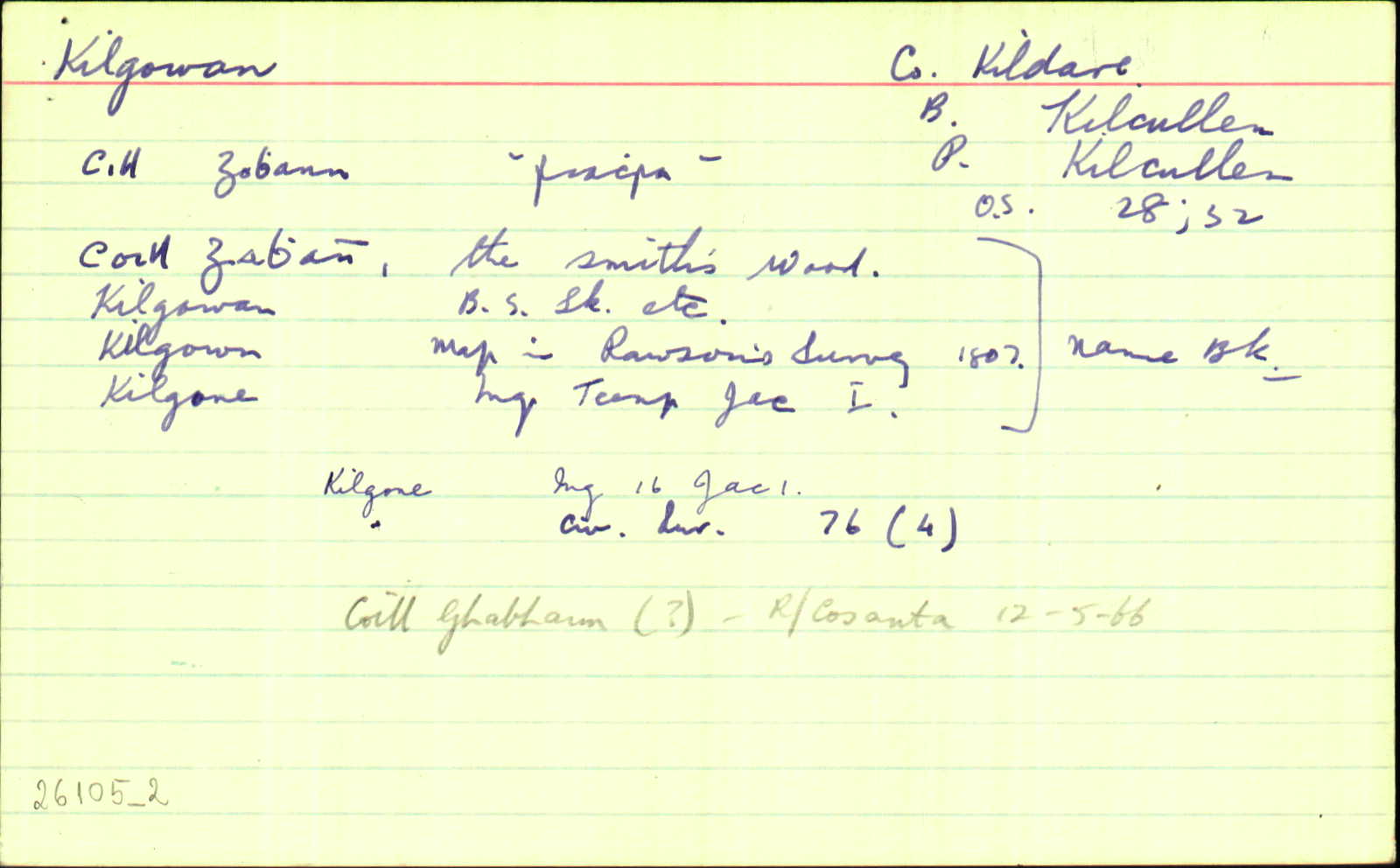
Kilgowan
(English)
Hierarchy
county
barony
civil parish
Explanatory note
Centrepoint
53.0802, -6.76631latitude, longitude
Irish Grid (with letter)
Computing...
Irish Grid (without letter)
Computing...
Irish Transverse Mercator (ITM)
Computing...
Archival records
Historical references
| 1100c |
i Cill Achaid Goan?
|
CGSH Leathanach: 704.133
|
| 1302-6 |
Kylgeban, Chapel de
[Kylgehan i gcló, "read Kylgeban" lch. xii]
|
Pap. Tax. Leathanach: 243
|
| 1504 |
Killgon
|
Alen's Reg. Leathanach: 257
|
| 1504 |
Kilgon
|
Alen's Reg. Leathanach: 257
|
| 1504 |
Gilgon
|
Alen's Reg. Leathanach: 258
|
| 1530c |
Kilgon, Capella de
|
Rep. Vir. Leathanach: 212
|
| 1588 |
Kilgone
|
F Leathanach: 5257
|
| 1604 |
Kilgone
|
CPR Leathanach: 39
|
| 1616 |
Kilgone
|
Inq. Lag. Leathanach: 16 J I
|
| 1620 |
Killgoen
|
Inq. Lag. Leathanach: 36 J I
|
| 1642/4/20 |
Killgowin
|
Dep. 1641 Leathanach: 813 323v
|
| 1654 |
Kilgone
|
CS VIII Leathanach: 76
|
| 1654 |
Kilgoone
|
CS VIII Leathanach: 98
|
| 1654 |
Kilgonne
x2
|
CS VIII Leathanach: 97
|
| 1655 |
Killgowen
|
|
| 1659 |
Killgoan
|
Cen. Leathanach: 408
|
| 1660c |
Killgone
|
BSD (CD) Leathanach: 57
|
| 1660c |
Killyone
|
BSD (CD) Leathanach: Index
|
| 1685 |
Killgowen
|
|
| 1716 |
Kilgone, Killgowan als
|
CGn. Leathanach: 16.396.7803
|
| 1722 |
Kilgowan
|
CGn. Leathanach: 35.66.20922
|
| 1722 |
Killgowan
|
CGn. Leathanach: 35.66.20922
|
| 1750c |
Killgowen
|
LN: Ms. Map Leathanach: 16H34(10)
|
| 1783 |
Kilgown
|
|
| 1807 |
Kilgowan
|
Stat. Surv. (CD) Leathanach: iv
|
| 1807 |
Kilgowan
|
Stat. Surv. (CD) Leathanach: xliii
|
| 1807 |
Kilgowan
|
Stat. Surv. (CD) Leathanach: 210
|
| 1812 |
Kilgowan
|
Leet II Leathanach: 29
|
| 1812 |
Kilgoan
|
LN: Ms. Map Leathanach: 16H15(4)
|
| 1822 |
Gillgone, Killgowan ows.
|
CGn. Leathanach: 772.522.523658
|
| 1822 |
Killgowan
|
CGn. Leathanach: 774.287.524622
|
| 1837 |
Kilgowan
|
BS:AL Leathanach: 1,33
|
| 1837 |
Kilgowan
|
Teacher (Divine):AL (CD) Leathanach: 1,33
|
| 1837 |
Kilgowan
|
Browning, J. P.:AL Leathanach: 1,33
|
| 1837 |
Kilgowan
|
Cole, W.:AL Leathanach: 1,33
|
| 1837 |
Kilgowan
|
Hardy, J.:AL Leathanach: 1,33
|
| 1837 |
Kilgown
[Map]
|
Stat. Survey (CD):AL Leathanach: 1,33
|
| 1837 |
Kilgone
|
Inq. J I:AL Leathanach: 1,33
|
| 1837 |
Coill gabhann, 'the smith's wood'
|
OD:AL Leathanach: 1,33
|
| 1837 |
Kilgowan
|
OD:AL Leathanach: 1,33
|
| 1837 |
[Kilgowan]
"…the Sand Hill police station…There is a ridge of it crossing the Dublin and Cork road which the inhabitants call 'the Raheens' there is another natural mound of it called the 'Sand Hilll'..."
|
Desc. Rem.:AL Leathanach: 1,33
|
| 2008 |
Ceall Achaidh Ghoan ('perhaps')
|
FSÁG Leathanach: 3.122
|
| 2009-2010 |
kilˈgoː(ə)n
|
Please note: Some of the documentation from the archives of the Placenames Branch is available here. It indicates the range of research contributions undertaken by the Branch on this placename over the years. It may not constitute a complete record, and evidence may not be sequenced on the basis of validity. It is on this basis that this material is made available to the public.
Archival and research material provided on this site may be used, subject to acknowledgement. Issues regarding republication or other permissions or copyright should be addressed to logainm@dcu.ie.
Permanent link
https://www.logainm.ie/26105.aspxFurther information about this place
Open data
Application programming interface (API)
Available under
Creative Commons Attribution 4.0 International (CC BY 4.0)
API key required to access data
Linked Logainm
Formats: RDF | RDF N3 | RDF JSON | RDF XML
Operated by Digital Repository of Ireland