Hierarchy
county
barony
municipal district
civil parish
electoral division
townland
sub-townland
sub-townland
Bunawonder
(English)
Hierarchy
county
barony
municipal district
civil parish
electoral division
townland
Centrepoint
52.2333, -9.87773latitude, longitude
Irish Grid (with letter)
Computing...
Irish Grid (without letter)
Computing...
Irish Transverse Mercator (ITM)
Computing...
Archival records
Historical references
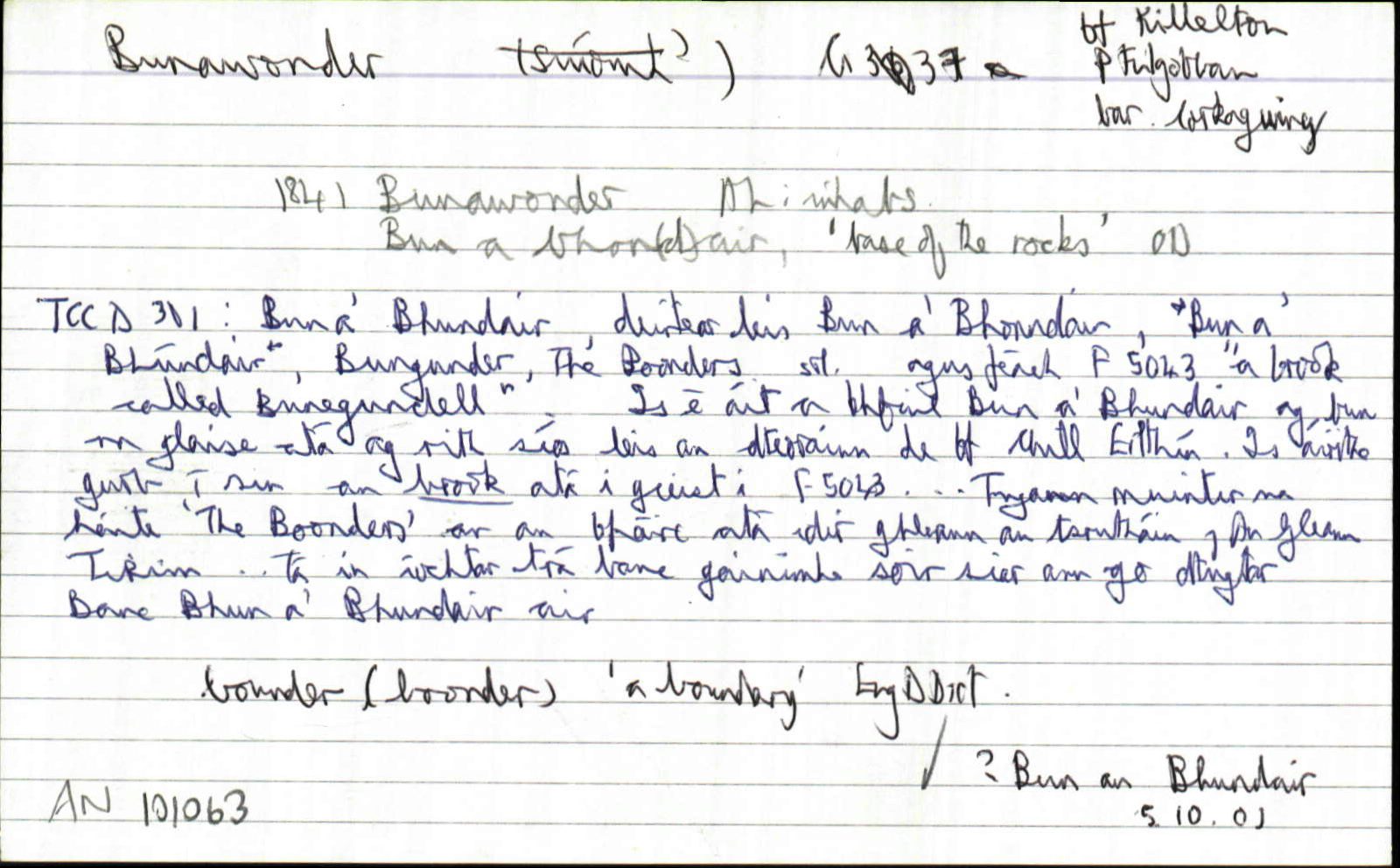
| 1587 |
Buneg[undell]
|
F Leathanach: 5043
|
| 1841 |
Bunawonder
|
|
| 1841 |
Bun a bhon(d)air, 'base of the rocks'
|
|
| 1939 |
Bun a' Bhundair--Deirtear leis, 'Bun a' Bhonndair, 'Bun a Bhúndair', 'Bungunder', 'The Boonders' srl.
Ní fios cad é ceart-fhuirm na hainme...Is é áit a bhfuil Bun a' Bhundair ag bun na glaise atá ag rith síos leis an dteorainn thiar de BhF Chill Eilthín. Is áirithe gurab í sin an brook atá i gceist in F5043
|
|
| 1971 |
ˌbunəˈwundər
|
Áit. Cainteoir: TM, Uimhir : T308b5
|
| 1971 |
ˌbunəˈwundər
|
Áit. Cainteoir: PD, Uimhir : T309a1
|
Please note: Some of the documentation from the archives of the Placenames Branch is available here. It indicates the range of research contributions undertaken by the Branch on this placename over the years. It may not constitute a complete record, and evidence may not be sequenced on the basis of validity. It is on this basis that this material is made available to the public.
Archival and research material provided on this site may be used, subject to acknowledgement. Issues regarding republication or other permissions or copyright should be addressed to logainm@dcu.ie.