Hierarchy
county
barony
municipal district
civil parish
electoral division
townland
townland
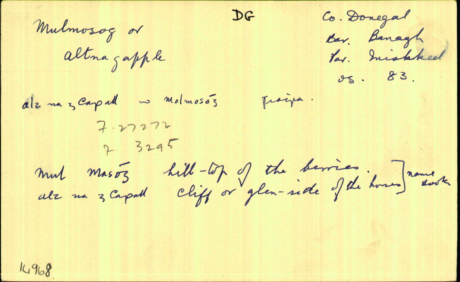
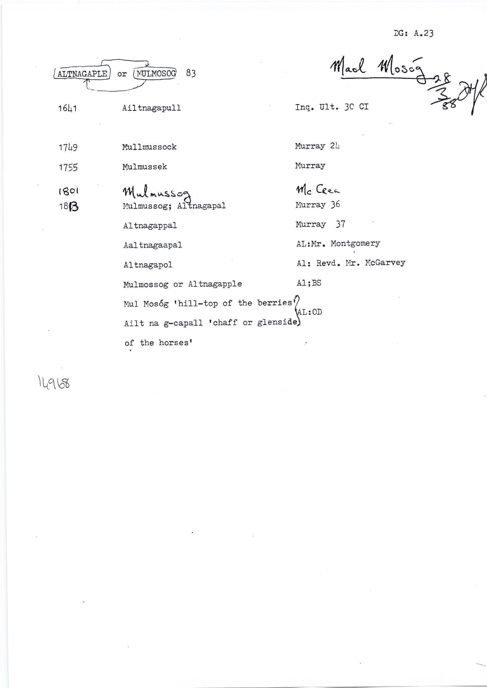
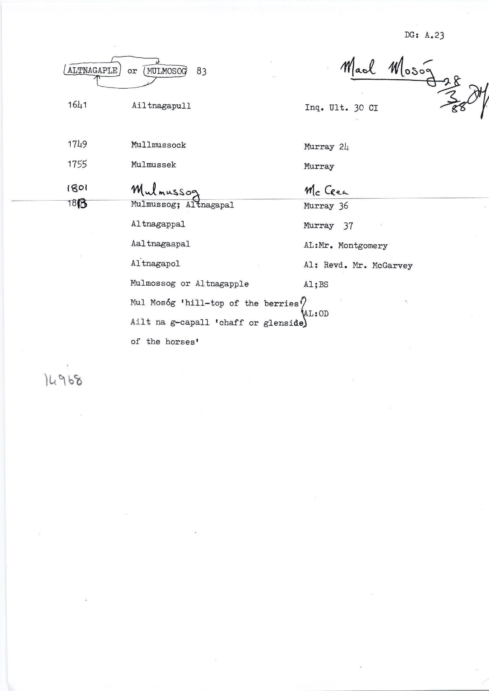
Mulmosog or Altnagapple
(English)
Hierarchy
county
barony
municipal district
civil parish
electoral division
Centrepoint
54.7169, -8.38059latitude, longitude
Irish Grid (with letter)
Computing...
Irish Grid (without letter)
Computing...
Irish Transverse Mercator (ITM)
Computing...
Properties
GGaeltacht
Archival records
Historical references
| 1641 |
Ailtnagapull
|
Inq. Ult. Leathanach: 30 CI
|
| 1749 |
Mullmussock
1
|
Murray Leathanach: 24
|
| 1755 |
Mulmussek
2
|
|
| 1801 |
Mulmussog
|
|
| 1813-4 |
Altnagappal
3
|
Murray Leathanach: 37
|
| 1813-4 |
Mullmossog; Altnagapal
3
|
Murray Leathanach: 36
|
| 1835 |
Mulmossog or Altnagapple
|
|
| 1835 |
Altnagapol
|
|
| 1835 |
Altnagaappal
|
|
| 1835 |
Ailt na g-capall 'cliff or glenside of the horses'
|
|
| 1835 |
Mul Mosóg 'hill-top of the berries'
|
Please note: Some of the documentation from the archives of the Placenames Branch is available here. It indicates the range of research contributions undertaken by the Branch on this placename over the years. It may not constitute a complete record, and evidence may not be sequenced on the basis of validity. It is on this basis that this material is made available to the public.
Archival and research material provided on this site may be used, subject to acknowledgement. Issues regarding republication or other permissions or copyright should be addressed to logainm@dcu.ie.