Hierarchy
county
barony
civil parish
townland, island or archipelago
subunits
townland, island or archipelago
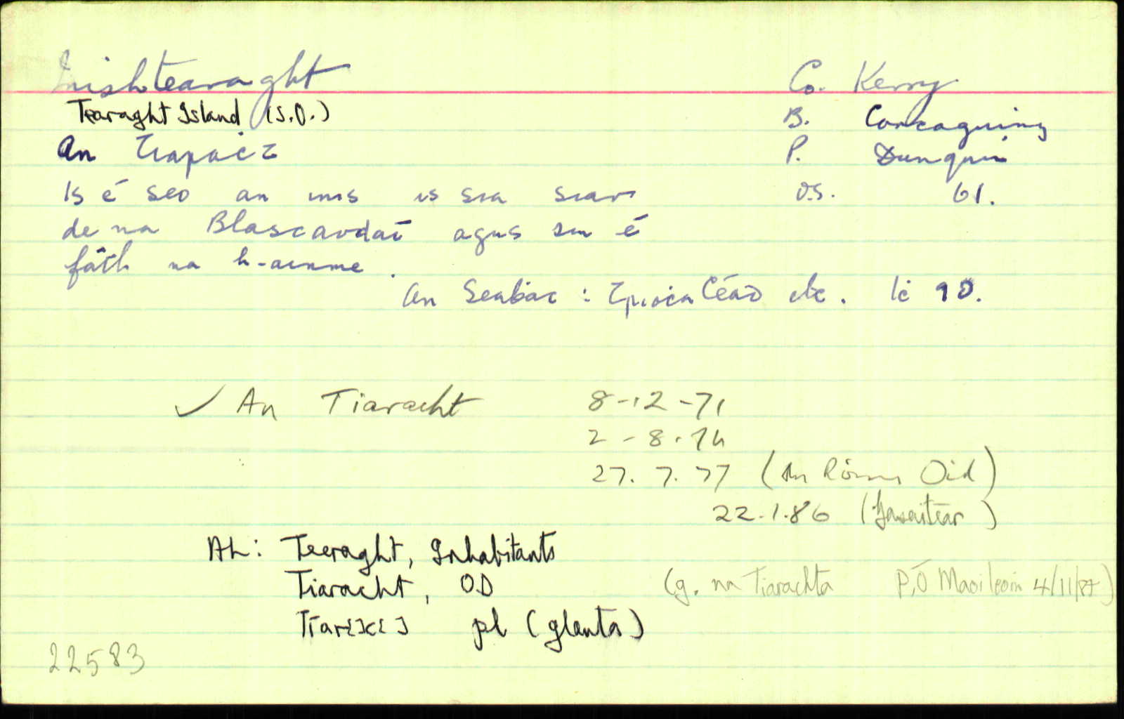
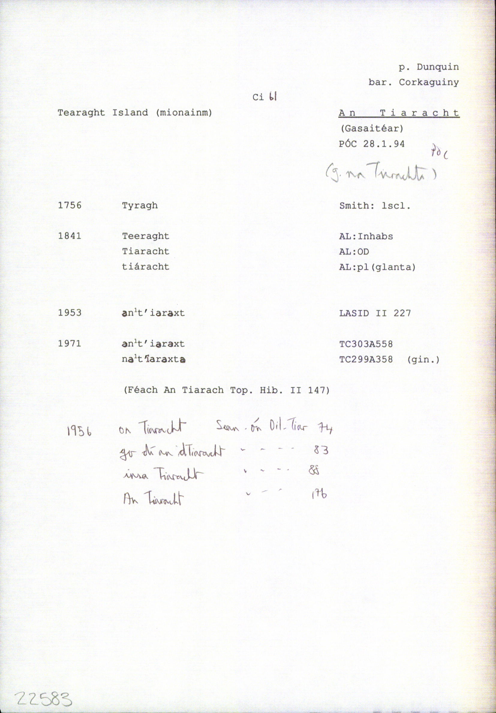
Tearaght Island
(English)
Centrepoint
52.0763, -10.6552latitude, longitude
Irish Grid (with letter)
Computing...
Irish Grid (without letter)
Computing...
Irish Transverse Mercator (ITM)
Computing...
Properties
GGaeltacht
Archival records
Historical references
| 1841 |
Teeraght
|
Inhabs.:AL Leathanach: Ci042,22
|
| 1841 |
Tyragh
|
Smith Hist. Kerry:AL Leathanach: Ci042,22
|
| 1841 |
Tiaracht, 'meaning unknown'
|
OD:AL Leathanach: Ci042,22
|
| 1841 |
Tiaracht
[glanta]
|
pl:AL Leathanach: Ci042,22
|
| 1841 |
Tearaght
|
OD:AL Leathanach: Ci042,22
|
| 1841 |
[Tearaght]
"This island which is nearly circular is about 1/2 mile in diametre with a green pasture surfaace and appearing in the form of hay or corn stack, rising to the height of about 5 or 6 feet above the sea."
|
Desc. Rem.:AL Leathanach: Ci042,22
|
| 1953 |
ənˈt′iərəxt
|
|
| 1971 |
ənˈt′iərəxt
|
|
| 1971 |
nəˈt′iarəxtə
|
Please note: Some of the documentation from the archives of the Placenames Branch is available here. It indicates the range of research contributions undertaken by the Branch on this placename over the years. It may not constitute a complete record, and evidence may not be sequenced on the basis of validity. It is on this basis that this material is made available to the public.
Archival and research material provided on this site may be used, subject to acknowledgement. Issues regarding republication or other permissions or copyright should be addressed to logainm@dcu.ie.