Hierarchy
county
barony
municipal district
civil parish
electoral division
townland
townland
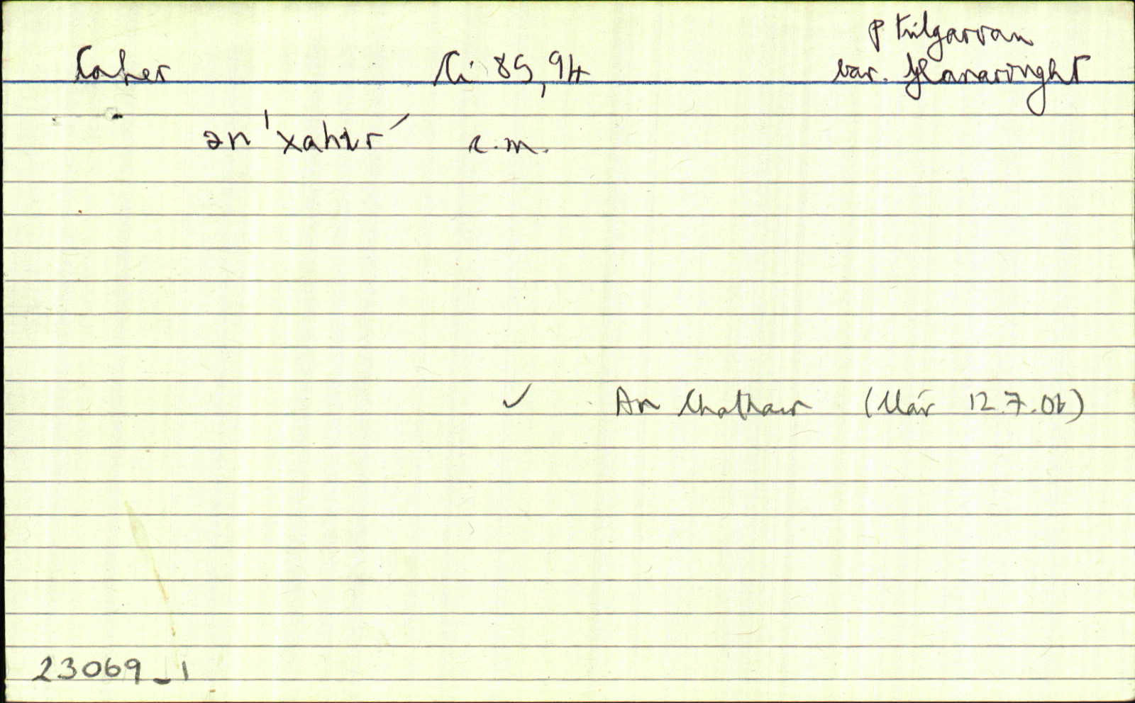
An Chathair
genitive: na Cathrach
(Irish)
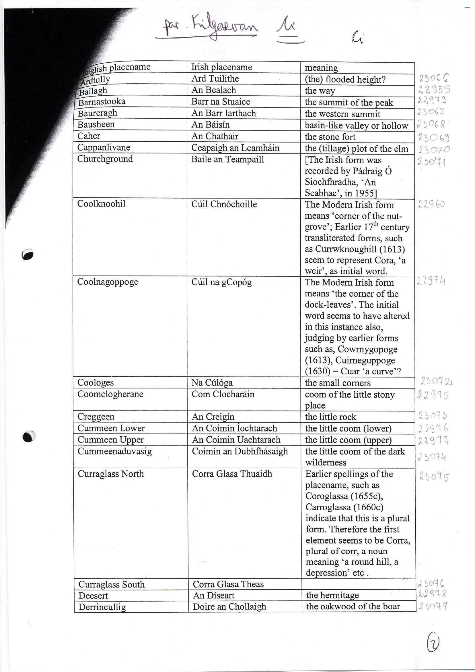
Caher
(English)
Hierarchy
county
barony
municipal district
civil parish
electoral division
Explanatory note
- English
the stone ring-fort
Centrepoint
51.9148, -9.40121latitude, longitude
Irish Grid (with letter)
Computing...
Irish Grid (without letter)
Computing...
Irish Transverse Mercator (ITM)
Computing...
Archival records
Historical references
| 1825 |
Cahir
|
TAB Leathanach: 12/85,5
|
| 1828 |
Caher
|
CGn. Leathanach: 180.561115, Imleabhar: 835
|
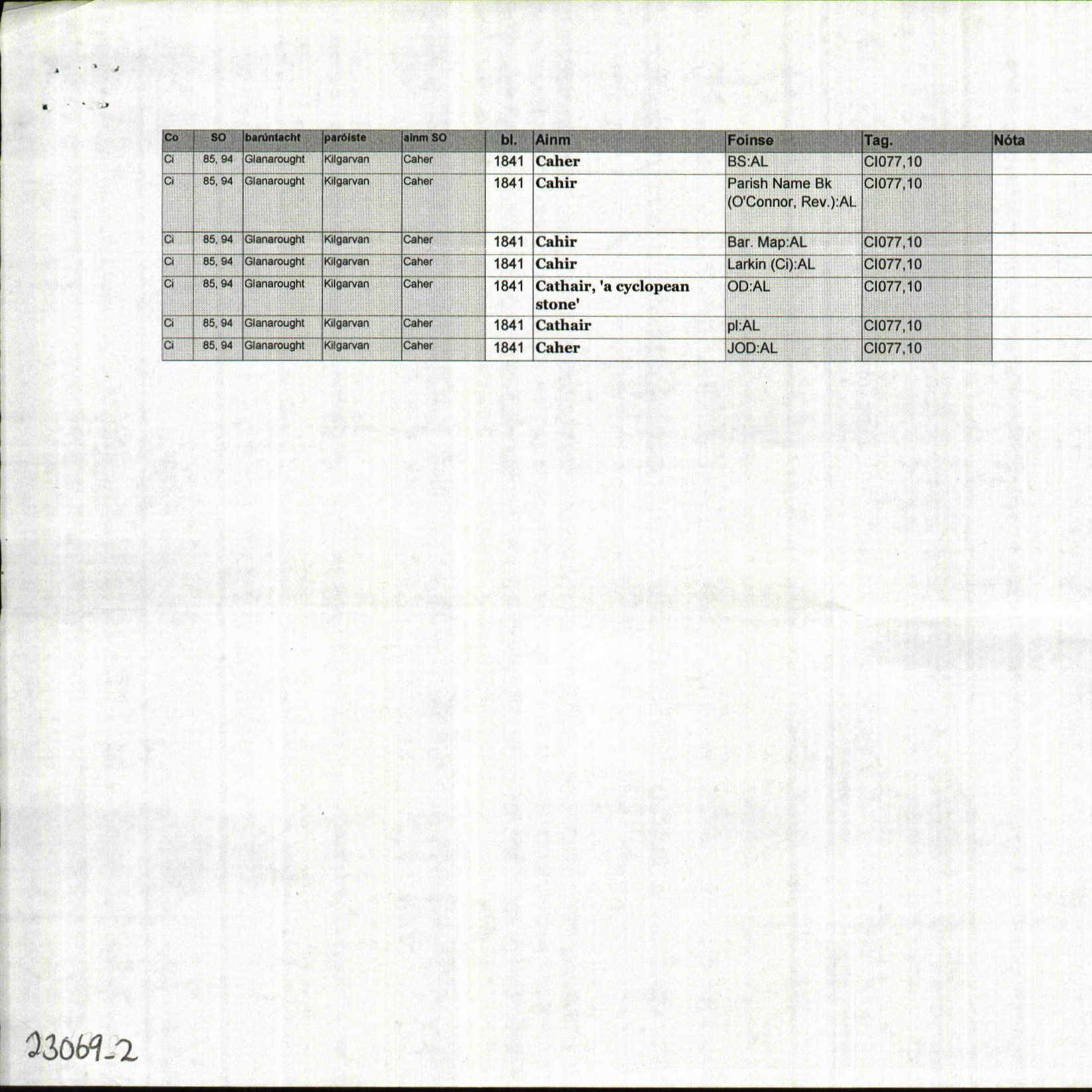
| 1841 |
Caher
|
BS:AL Leathanach: Ci077,10
|
| 1841 |
Cahir
|
Rev. O'Connor:AL Leathanach: Ci077,10
|
| 1841 |
Cahir
|
BM:AL Leathanach: Ci077,10
|
| 1841 |
Cahir
|
Larkin (Ci):AL Leathanach: Ci077,10
|
| 1841 |
Cathair, 'a cyclopean stone'
|
OD:AL Leathanach: Ci077,10
|
| 1841 |
Cathair
|
pl:AL Leathanach: Ci077,10
|
| 1841 |
Caher
|
OD:AL Leathanach: Ci077,10
|
| 1955 |
An Chathair
ən xɑhir′
"chun na Cathrach" M. Bn Uí Shúilleabháin. Is áirithe go raibh tuilleadh san ainm seo - ach ní heol domhsa cad é. An bf lastuaidh agus lastoir den Ruachtaigh.
|
An Seabhac:Cártaí Móra Leathanach: Ke/5
|
| 1970 |
ˌkahər ˈiːʃt, ˌkahər ˈweʃt
|
Áit. Cainteoir: DSG, Uimhir : T290a1
|
| 1970 |
ˈkahər
|
Áit. Cainteoir: DSG, Uimhir : T290a1
|
| 2006 |
An Chathair
the stone fort
|
Please note: Some of the documentation from the archives of the Placenames Branch is available here. It indicates the range of research contributions undertaken by the Branch on this placename over the years. It may not constitute a complete record, and evidence may not be sequenced on the basis of validity. It is on this basis that this material is made available to the public.
Archival and research material provided on this site may be used, subject to acknowledgement. Issues regarding republication or other permissions or copyright should be addressed to logainm@dcu.ie.