Hierarchy
county
barony
civil parish
townland
townland
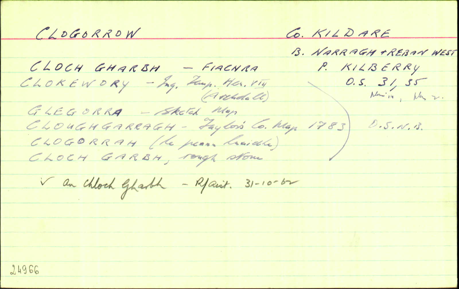
Clogorrow
(English)
Hierarchy
county
barony
civil parish
Centrepoint
53.026, -6.96918latitude, longitude
Irish Grid (with letter)
Computing...
Irish Grid (without letter)
Computing...
Irish Transverse Mercator (ITM)
Computing...
Archival records
Historical references
| 1752 |
Clogharagh
|
|
| 1783 |
Cloughgarragh
|
|
| 1811 |
Cloughgorrow
|
|
| 1827 |
Clogorrah
|
|
| 1837 |
Glegorra
|
BS:AL Leathanach: 1,16
|
| 1837 |
Cloughgarragh
|
Taylor Co. Map 1783:AL Leathanach: 1,16
|
| 1837 |
Clogorrah
|
TAB Leathanach: 1,16
|
| 1837 |
Cloughgorrow
|
Downes, Lord:AL Leathanach: 1,16
|
| 1837 |
Clagorrah
|
Proprietor (Duke of Leins.):AL Leathanach: 1,16
|
| 1837 |
Clokewory
|
Inq. H VIII (Archdall):AL Leathanach: 1,16
|
| 1837 |
Cloch garbh, 'rough stone'
|
OD:AL Leathanach: 1,16
|
| 1837 |
Clogorrah
|
pl:AL Leathanach: 1,16
|
| 1837 |
Clogorrow
|
OD:AL Leathanach: 1,16
|
| 1837 |
[Clogorrow]
"There is an Old Rath in the East part of townland that had a cave in it formerly now closed up…"
|
Desc. Rem.:AL Leathanach: 1,16
|
| 2009-2010 |
kləˈgorə
Annamh a chloistear
|
Please note: Some of the documentation from the archives of the Placenames Branch is available here. It indicates the range of research contributions undertaken by the Branch on this placename over the years. It may not constitute a complete record, and evidence may not be sequenced on the basis of validity. It is on this basis that this material is made available to the public.
Archival and research material provided on this site may be used, subject to acknowledgement. Issues regarding republication or other permissions or copyright should be addressed to logainm@dcu.ie.