Hierarchy
county
barony
civil parish
townland
townland
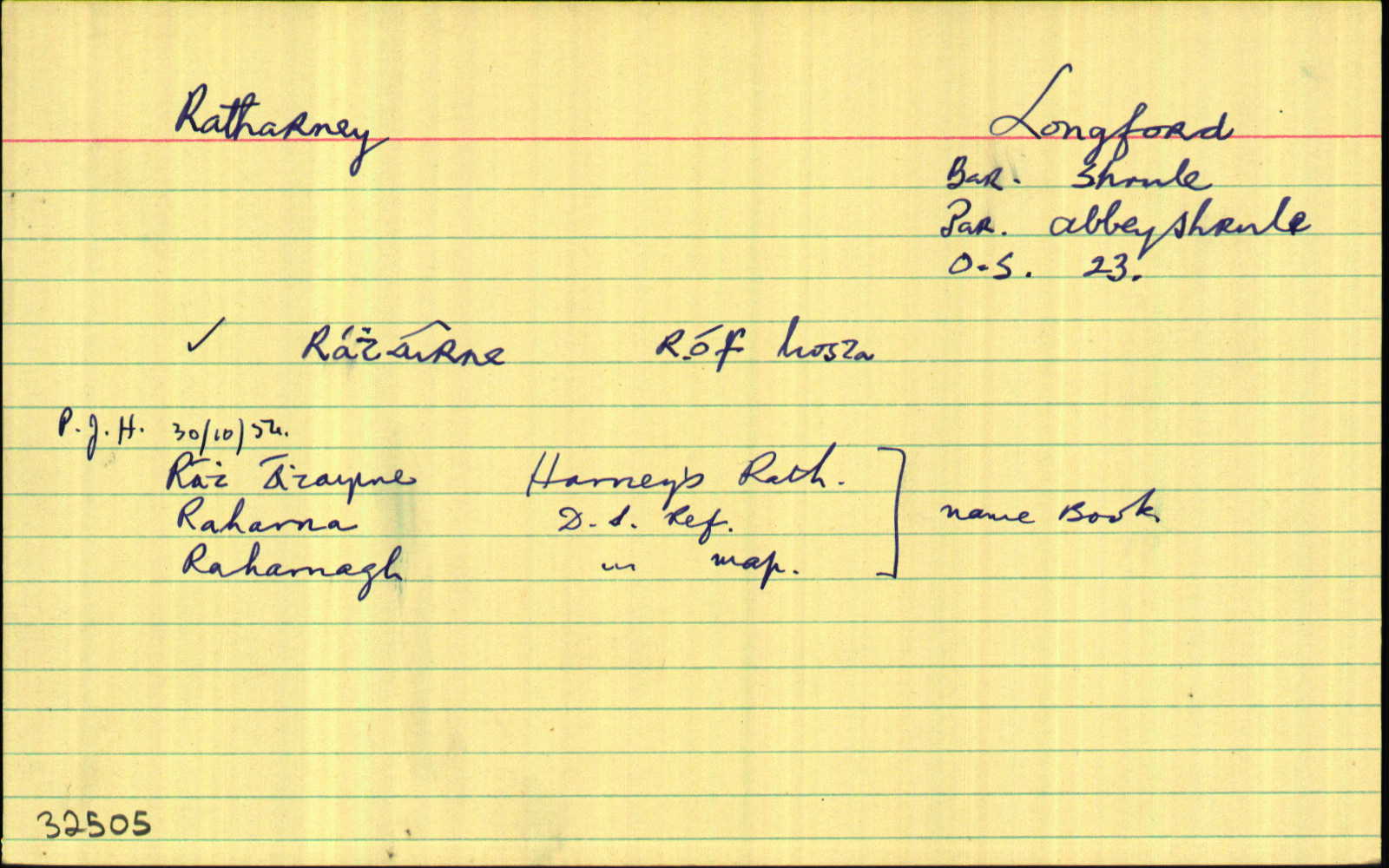
Ratharney
(English)
Hierarchy
county
barony
civil parish
Explanatory note
- English
ring-fort of sloes, of (the) ridge?
Centrepoint
53.5982, -7.65523latitude, longitude
Irish Grid (with letter)
Computing...
Irish Grid (without letter)
Computing...
Irish Transverse Mercator (ITM)
Computing...
Archival records
Historical references
| 1629 |
---------
|
|
| 1655 |
Raharna
|
|
| c.1660 |
Raharna
|
BSD Leathanach: 117
|
| 1751 |
Ratharne
|
CGn. Imleabhar: 148.299.99665
|
| 1813 |
Ratharney
|
|
| 1835 |
Ratharney
|
|
| 1835 |
Ratharney
|
|
| 1835 |
Ratharney
|
|
| 1835 |
Ratharney
|
|
| 1835 |
Ratharney
|
|
| 1835 |
Raharna
|
|
| 1835 |
Raharnagh
|
|
| 1835 |
Rath Athairne, “Harney’s Rath or earthen fort”
|
|
| 1835 |
Holy Well here Colum Kille
|
|
| 1835 |
...it has a gentleman’s seat called Smith Brook House on its south side, one fort called Ratharney Fort...
|
|
| 1908 |
Ráth Áirneadh, “fort of the sloe-tree”
|
MacGivney Leathanach: 195
|
| 2008 |
raˈhaˑrniˑ
|
Please note: Some of the documentation from the archives of the Placenames Branch is available here. It indicates the range of research contributions undertaken by the Branch on this placename over the years. It may not constitute a complete record, and evidence may not be sequenced on the basis of validity. It is on this basis that this material is made available to the public.
Archival and research material provided on this site may be used, subject to acknowledgement. Issues regarding republication or other permissions or copyright should be addressed to logainm@dcu.ie.