Hierarchy
county
barony
civil parish
townland
townland
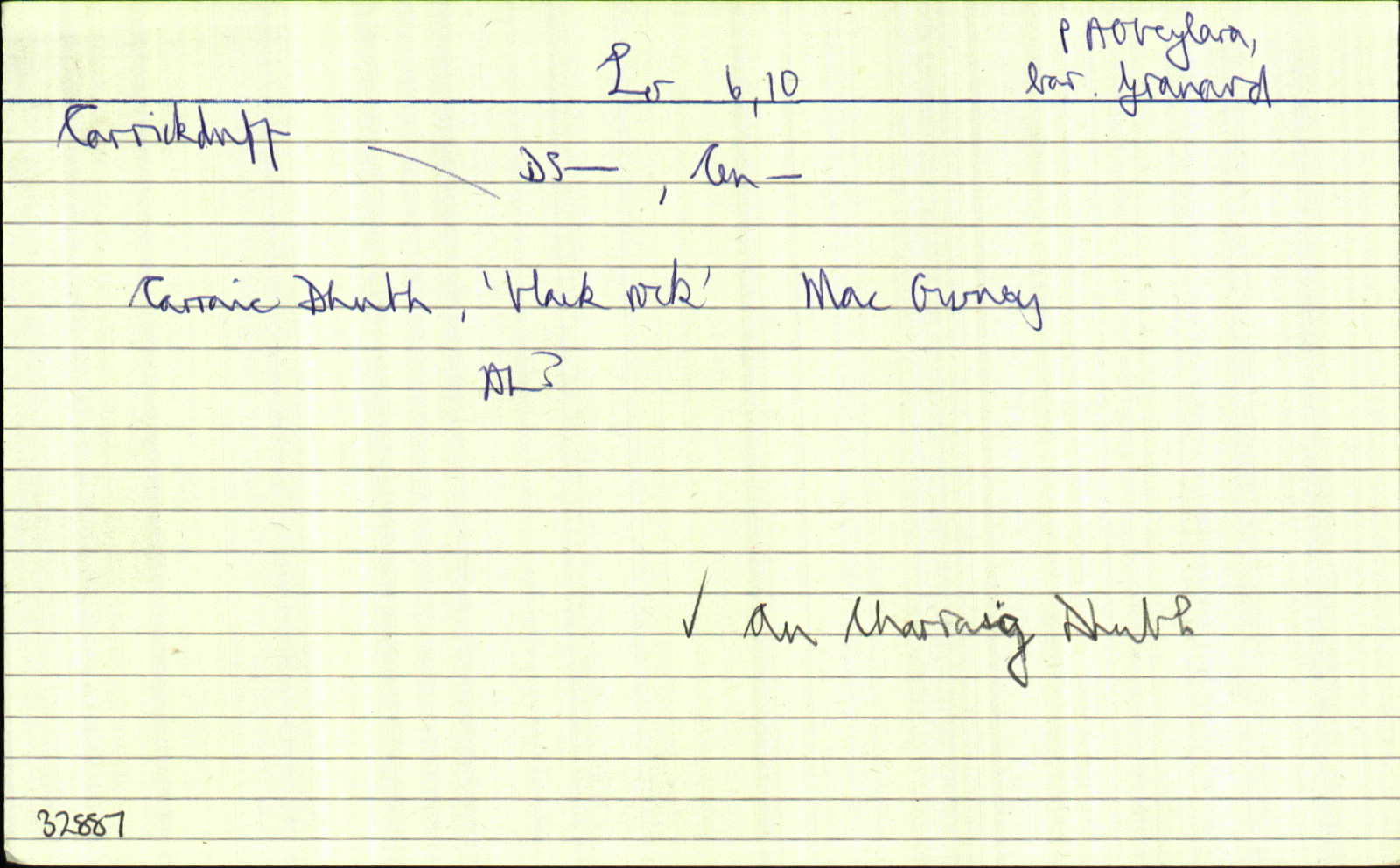
Carrickduff
(English)
Hierarchy
county
barony
civil parish
Centrepoint
53.8086, -7.52459latitude, longitude
Irish Grid (with letter)
Computing...
Irish Grid (without letter)
Computing...
Irish Transverse Mercator (ITM)
Computing...
Archival records
Historical references
|
An Charraig Dhubh
|
||
| 1629 |
----- [istigh le Clogh]
|
|
| 1717 |
Emlagh als. Carrickduffe
|
CGn. Leathanach: 22.377.12308
|
| 1765 |
Carrickduff owse Dalystown
|
CGn. Leathanach: 244.3.155548
|
| 1813 |
Carrickduff
|
|
| 1836 |
Carrickduff
|
|
| 1836 |
Carraic Dubh, “Black rock”
|
|
| 1836 |
...a large fort called Carrickduff fort...
|
|
| 1836 |
Carrickduff
|
|
| 1908 |
Carraic Dhubh, “black rock”, “the black rock which has given a name to this townland is there to be seen”
|
MacGivney Leathanach: 57
|
| 2007 |
karikˈdof
|
Please note: Some of the documentation from the archives of the Placenames Branch is available here. It indicates the range of research contributions undertaken by the Branch on this placename over the years. It may not constitute a complete record, and evidence may not be sequenced on the basis of validity. It is on this basis that this material is made available to the public.
Archival and research material provided on this site may be used, subject to acknowledgement. Issues regarding republication or other permissions or copyright should be addressed to logainm@dcu.ie.