Hierarchy
county
barony
civil parish
townland, island or archipelago
subunits
townland, island or archipelago
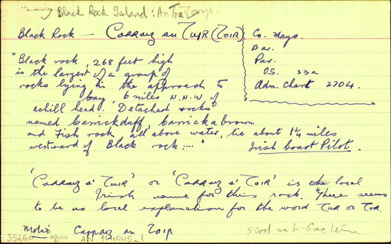
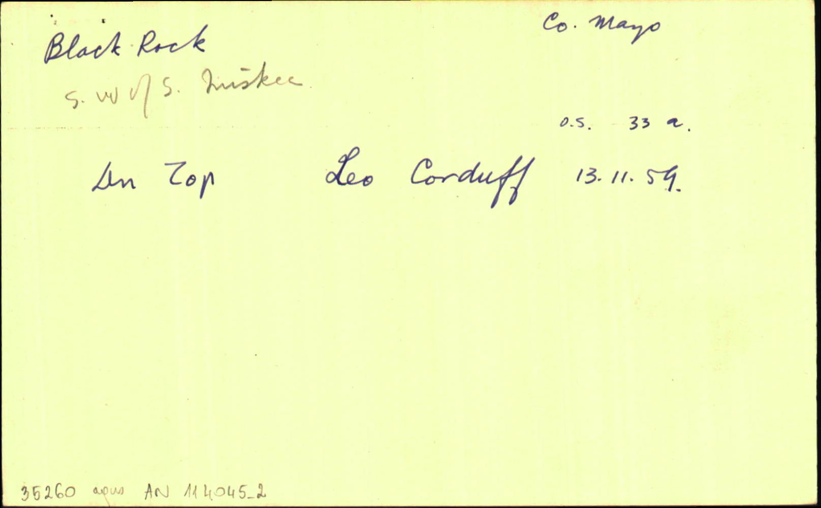
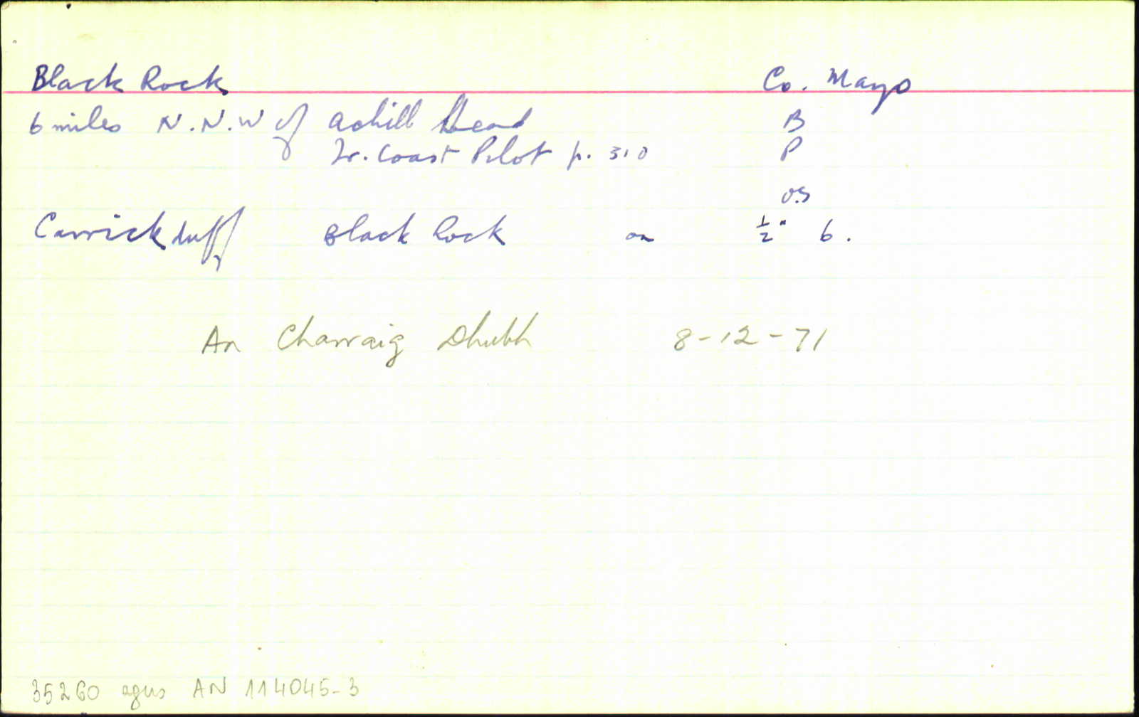
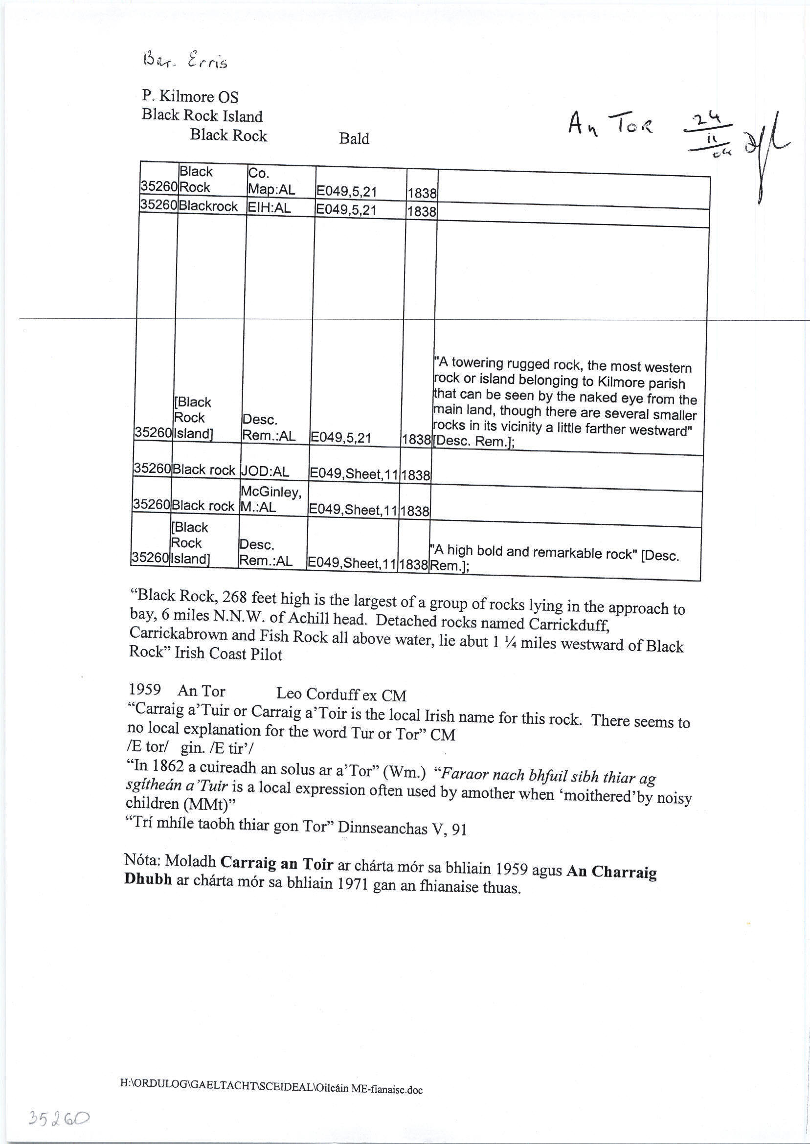
Black Rock Island
(English)
Centrepoint
54.067, -10.3192latitude, longitude
Irish Grid (with letter)
Computing...
Irish Grid (without letter)
Computing...
Irish Transverse Mercator (ITM)
Computing...
Properties
GGaeltacht
Archival records
Historical references
| 1590c |
Black Rock
|
|
| 1600c |
Fordnan Rock [sic]
|
|
| 1601 |
Blackrock, off the
|
CSPI Leathanach: 437 §81
|
| 1602c |
Blackrock
|
Dunlop Maps Leathanach: 21
|
| 1610c |
Blackrock
|
|
| 1776 |
Black Rock
|
Mackenzie Leathanach: 42
|
| 1792 |
Black Rocks
|
|
| 1793 |
Black Rock
|
|
| 1811 |
Black Rock
|
|
| 1830 |
Black Rock
|
|
| 1838 |
Black Rock
|
CM:AL Leathanach: ME113,21
|
| 1838 |
Blackrock
|
EIH:AL Leathanach: ME113,21
|
| 1838 |
[Black Rock Island]
"A towering rugged rock, the most western rock or island belonging to Kilmore parish that can be seen by the naked eye from the main land, though there are several smaller rocks in its vicinity a little farther westward" [Desc. Rem.];
|
Desc. Rem.:AL Leathanach: ME113,21
|
| 1838 |
Black rock
|
OD:AL Leathanach: E049,Sheet,11
|
| 1838 |
Black rock
|
McGinley, M.:AL Leathanach: E049,Sheet,11
|
| 1838 |
[Black Rock Island]
"A high bold and remarkable rock" [Desc. Rem.];
|
Desc. Rem.:AL Leathanach: E049,Sheet,11
|
Please note: Some of the documentation from the archives of the Placenames Branch is available here. It indicates the range of research contributions undertaken by the Branch on this placename over the years. It may not constitute a complete record, and evidence may not be sequenced on the basis of validity. It is on this basis that this material is made available to the public.
Archival and research material provided on this site may be used, subject to acknowledgement. Issues regarding republication or other permissions or copyright should be addressed to logainm@dcu.ie.