

Hierarchy
county
barony
civil parish
townland
subunits
townland
Rathbranchurch
(English)
Hierarchy
county
barony
civil parish
Centrepoint
53.7707, -6.6025latitude, longitude
Irish Grid (with letter)
Computing...
Irish Grid (without letter)
Computing...
Irish Transverse Mercator (ITM)
Computing...
Archival records
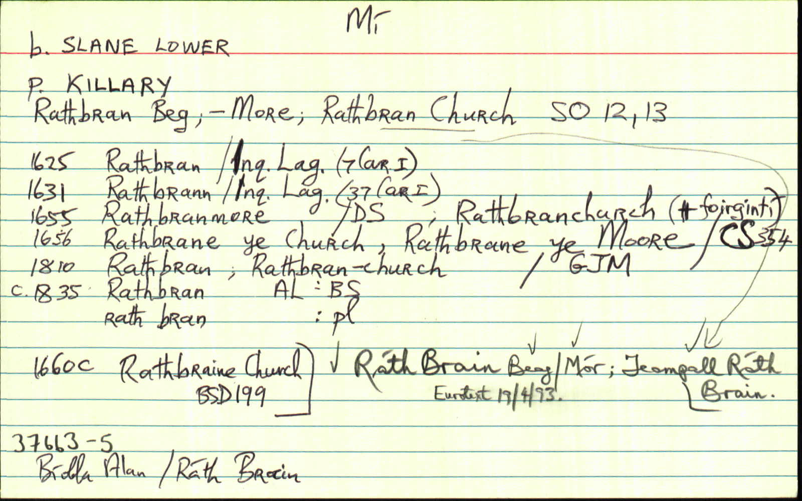
Historical references
| 1654 |
Rathbrane ye Church
Walter Evers Irish Papist - bounded on ye east with ye lands ot Brownestowne on ye west with Parsonstowne on ye North with ye lands of Braystowne & on the south with ye lands of
Creywood
|
CS V 356
|
| 1666c |
Rathbraine Church
|
|
| 1741 |
Rathbrand Le Temple als Rathbrand Church
Gustavus Lord Viscount Boyne ... Nathaniel Clements ... Manor Castle Town and Lands of Stackallen alias Stacallan Stacallan als Stacallen ... Estate of the late King James the Second Cansestown Hardmanstown Plowland with the water mill called the mill of Stackallen standing ... Shalvinstown als Slavinstown part of Hilltown Tankardstown Beathsland oart of Rathlangstown als Rawlingstown Rathbrand Le Temple als Rathbrand Church Brownstown part of Hopkinstown Cloughled als Horestown Lisneboy als Lissboy part of one of the Fifteen Polls of Ballybreechy Killblaine als Killneere als Killgrin Aghreah Cors[]ople Corrgreah which four last mentd, parcells are commonly called by the name of the Four Polls of Tivercher part of Curbogge part of the Turfbogge Wilkinstown ... Mullagha ... in the Baronys of Slane Navan Kells and Morgallion ...
|
CGn. 103.479.72261
|
| 1836 |
Rathbran Church
|
OD:AL Leathanach: Mí058,19
|
| 1836 |
[Rathbran Church]
"In the S. E. part is a mound and a Danish fort. In the N. part is a Danish fort…"
|
Desc. Rem.:AL Leathanach: Mí058,19
|
| 1836 |
Rathbran Church
|
Cess Coll.:AL Leathanach: Mí058,19
|
| 1836 |
Rathbran Church
|
TAB Leathanach: Mí058,19
|
| 1836 |
Rathbran Church
|
Bar. Cons.:AL Leathanach: Mí058,19
|
| 1836 |
Rathbran Church
|
Co. Map 1812:AL Leathanach: Mí058,19
|
| 1836 |
Rathbran
|
Beaufort Map 1797:AL Leathanach: Mí058,19
|
| 1836 |
Rathbranchurch
|
Petty Eng. Map 1683:AL Leathanach: Mí058,19
|
| 1836 |
Rathbranchurch
|
DS:AL Leathanach: Mí058,19
|
| 1836 |
Rath bran
|
OC:AL Leathanach: Mí058,19
|
| 1836 |
Rathbran Church
|
BS:AL Leathanach: Mí058,19
|
| 1836 |
Rathbran Church
|
HCSV:AL Leathanach: Mí058,19
|
| 1836 |
Bran's fort, 'arx Brani'
|
OD:AL Leathanach: Mí058,19
|
| 1836 |
Rath bran
"No burial now here." [pl]
|
pl:AL Leathanach: Mí058,19
|
Please note: Some of the documentation from the archives of the Placenames Branch is available here. It indicates the range of research contributions undertaken by the Branch on this placename over the years. It may not constitute a complete record, and evidence may not be sequenced on the basis of validity. It is on this basis that this material is made available to the public.
Archival and research material provided on this site may be used, subject to acknowledgement. Issues regarding republication or other permissions or copyright should be addressed to logainm@dcu.ie.