Hierarchy
county
barony
civil parish
townland
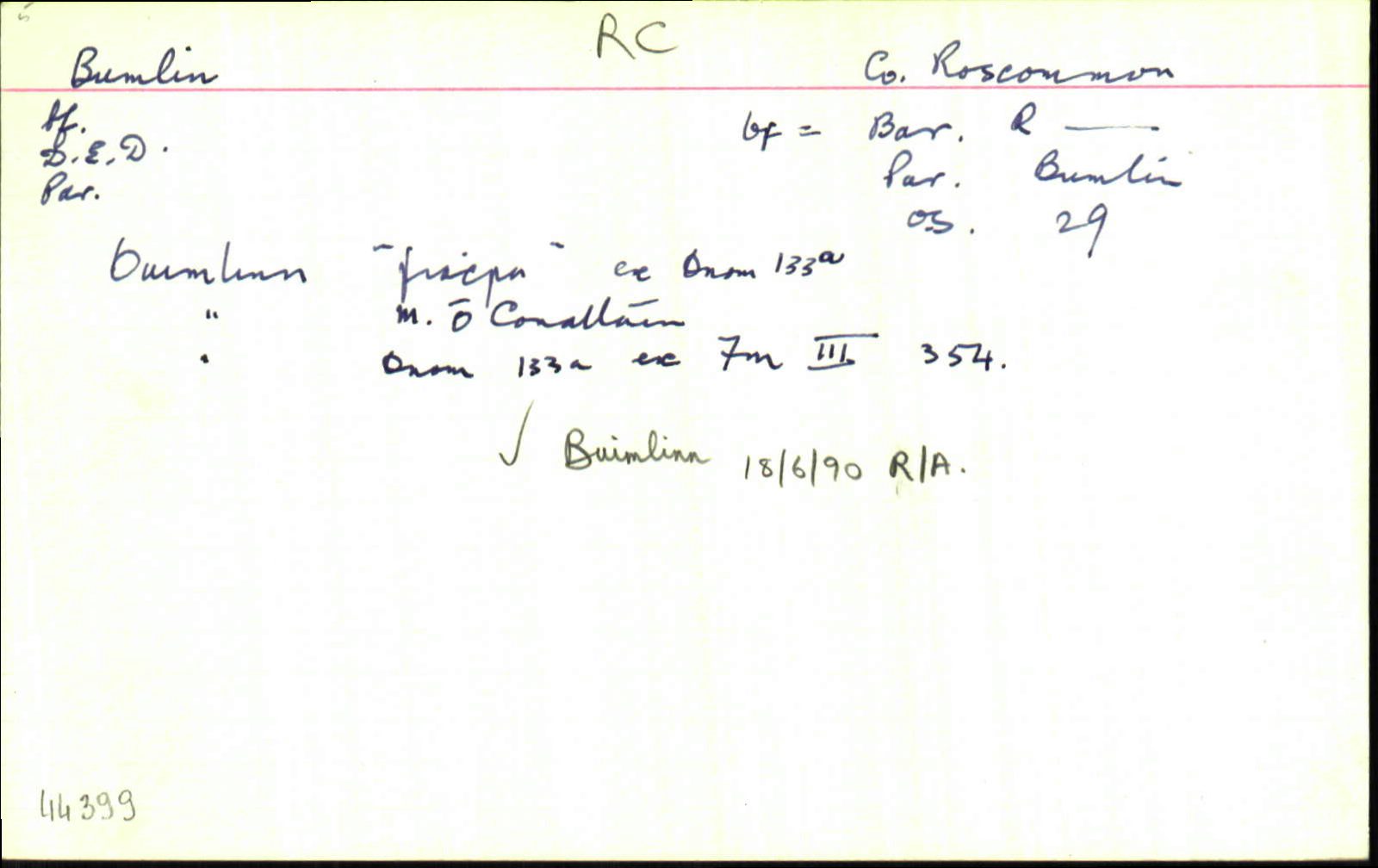
Bumlin
(English)
Centrepoint
53.7674, -8.07799latitude, longitude
Irish Grid (with letter)
Computing...
Irish Grid (without letter)
Computing...
Irish Transverse Mercator (ITM)
Computing...
Archival records
Historical references
| 1837 |
Bumlin
|
BS:AL Leathanach: RC011,1
|
| 1837 |
Bumlin
|
Inq. C II:AL Leathanach: RC011,1
|
| 1837 |
Bumlin
|
Conry, T.:AL Leathanach: RC011,1
|
| 1837 |
Bumlin
|
Co. Treas. List:AL Leathanach: RC011,1
|
| 1837 |
Bumlin
|
S&V:AL Leathanach: RC011,1
|
| 1837 |
Bumlin called also Strokestown
|
Pop. Rep. 1821:AL Leathanach: RC011,1
|
| 1837 |
Strokestown or Bumlin
|
HCER 1826:AL Leathanach: RC011,1
|
| 1837 |
Bumlin
|
Weld:AL Leathanach: RC011,1
|
| 1837 |
Strokestown
["Weld, p.15, 21, 134, 135, 168, 306"];
|
Weld:AL Leathanach: RC011,1
|
| 1837 |
Buimlinn, 'cow pond'
|
OD:AL Leathanach: RC011,1
|
| 1837 |
Bumlin
|
Inq. Eliz. I:AL Leathanach: RC011,1
|
| 1837 |
Bumlin
|
Inq. J I:AL Leathanach: RC011,1
|
| 1837 |
Rumlin
"B?" [dúch];
|
Inq. J I:AL Leathanach: RC011,1
|
| 1837 |
Bomlin
|
Inq. J I:AL Leathanach: RC011,1
|
| 1837 |
Bumlin
[peann JOD];
|
dúch dearg:AL Leathanach: RC011,1
|
| 1837 |
[Bumlin]
"A great portion of this townland is thickly wooded at the western boundary...Scramague River forms a part of southern, and the whole of eastern boundary along which there is a stripe of bog & rough pasture" [Desc. Rem.];
|
Desc. Rem.:AL Leathanach: RC011,1
|
Please note: Some of the documentation from the archives of the Placenames Branch is available here. It indicates the range of research contributions undertaken by the Branch on this placename over the years. It may not constitute a complete record, and evidence may not be sequenced on the basis of validity. It is on this basis that this material is made available to the public.
Archival and research material provided on this site may be used, subject to acknowledgement. Issues regarding republication or other permissions or copyright should be addressed to logainm@dcu.ie.