Hierarchy
county
barony
civil parish
townland
Hierarchy
county
barony
civil parish
Explanatory note
- Gaeilge
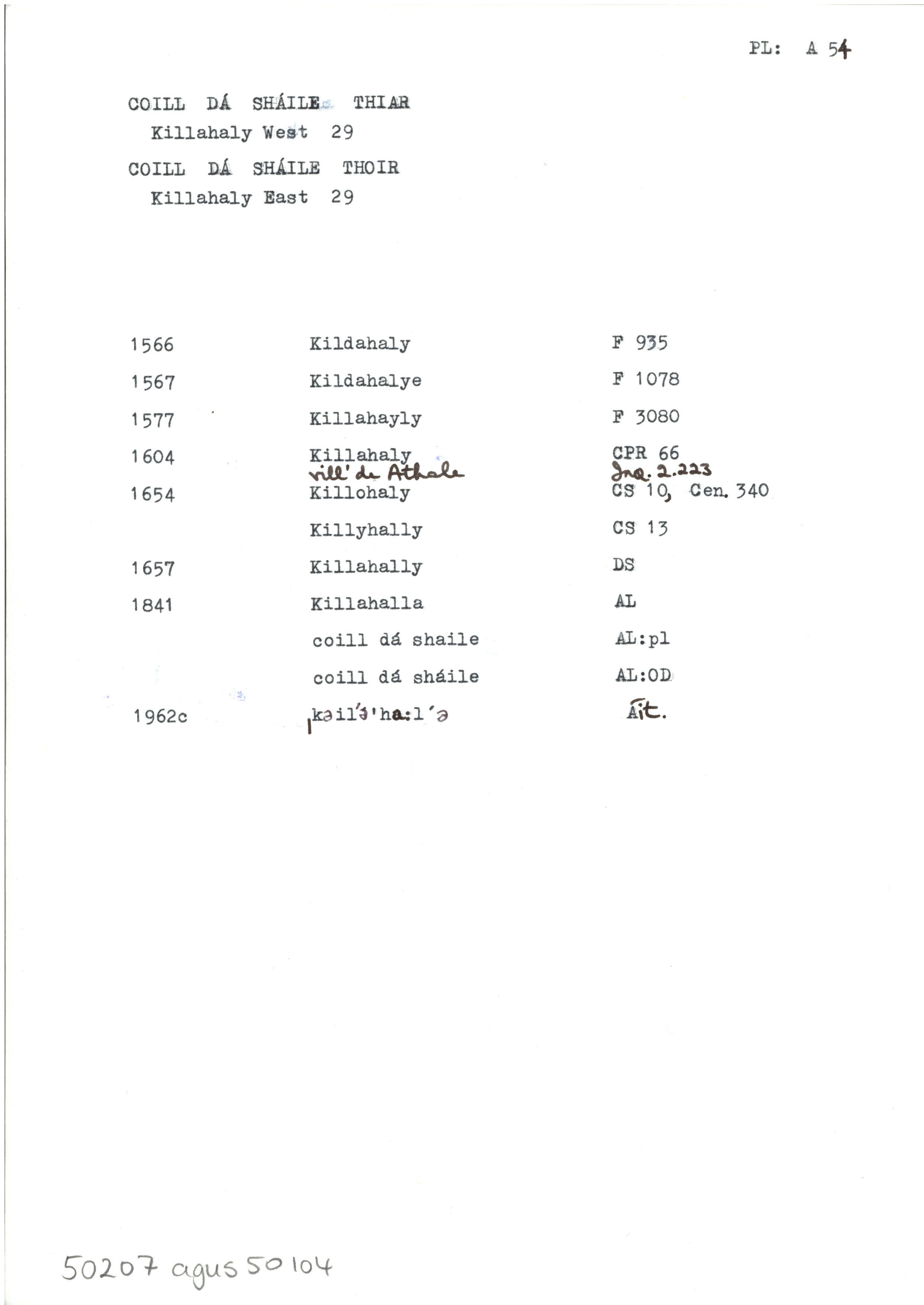
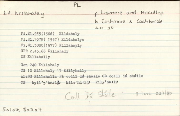
wood of (the) two tidal streams?
Tá an bf Coill Dá Sháile Thoir suite idir An Abhainn Mhór agus An Abha Bheag. Tá 'highest point to which Ordinary Tides flow' léirithe ar léarscáil SO ar an Abha Bheag. Abhainn thaoidmhear is brí le sáile anseo is dócha. - English
wood of (the) two tidal streams?
The townland Coill Dá Sháile Thoir is situated between the River Blackwater and the Owbeg River. The OS map shows 'highest point to which Ordinary Tides flow' here on the Owbeg. The word sáile probably means 'tidal river' here.
Centrepoint
Archival records
Please note: Some of the documentation from the archives of the Placenames Branch is available here. It indicates the range of research contributions undertaken by the Branch on this placename over the years. It may not constitute a complete record, and evidence may not be sequenced on the basis of validity. It is on this basis that this material is made available to the public.
Archival and research material provided on this site may be used, subject to acknowledgement. Issues regarding republication or other permissions or copyright should be addressed to logainm@dcu.ie.