Hierarchy
county
barony
civil parish
townland
townland
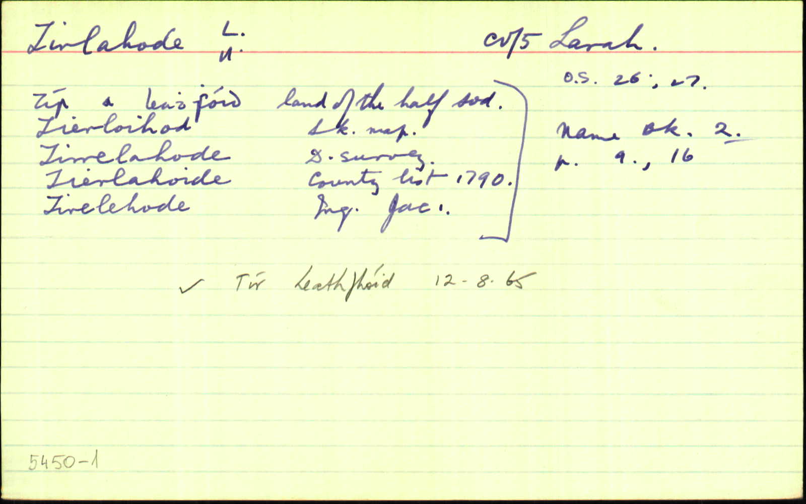
Tír Leathfhóid Uachtarach
genitive: Thír Leathfhóid Uachtarach
non-validated name (What is this?)
(Irish)
Tirlahode Upper
(English)
Hierarchy
county
barony
civil parish
Explanatory note
- English
land of (the) uneven sod
Centrepoint
53.9408, -7.16572latitude, longitude
Irish Grid (with letter)
Computing...
Irish Grid (without letter)
Computing...
Irish Transverse Mercator (ITM)
Computing...
Archival records
Historical references
| 1609 |
Tirflahod
sic
|
|
| 1609 |
Tirlahode
|
|
| 1620 |
Tyrelehode
|
|
| 1652 |
Tirelahode
|
|
| 1655-57 |
Tirtachode
sic
|
|
| c.1660 |
Tirrelahode
|
|
| c.1700 |
Tierlahoide
|
|
| 1821 |
Terrylahad upper
|
|
| 1821 |
Terry Lahad upper
|
|
| 1821 |
Derrylahad upper
|
|
| 1836 |
Tierlahood
|
TAB Leathanach: Ca048,9
|
| 1836 |
Tirrelahode
|
DS:AL Leathanach: Ca048,9
|
| 1836 |
Tír a' leathfhóid, 'land of the half sod'
|
OD:AL Leathanach: Ca048,9
|
| 1836 |
toire leath fho//id
|
OC:AL Leathanach: Ca048,9
|
| 1836 |
Tierlahoide
|
Co. List 1790:AL Leathanach: Ca048,9
|
| 1836 |
Tirelahode
|
Commonwealth Survey:AL Leathanach: Ca048,9
|
| 1836 |
Terrylahed
|
Erskine, Rev.:AL Leathanach: Ca048,9
|
| 1836 |
Tierlahed
|
Brady, Rev. H.:AL Leathanach: Ca048,9
|
| 1836 |
Tirrloihod
|
BS:AL Leathanach: Ca048,9
|
| 1836 |
Tirlaho//de
|
OD:AL Leathanach: Ca048,9
|
| 1836 |
[Tirlahode Upper]
"Contains two old forts" [Situation];
|
Situation:AL Leathanach: Ca048,9
|
| 1836 |
toire leath-fho//id
|
pl:AL Leathanach: Ca048,9
|
Please note: Some of the documentation from the archives of the Placenames Branch is available here. It indicates the range of research contributions undertaken by the Branch on this placename over the years. It may not constitute a complete record, and evidence may not be sequenced on the basis of validity. It is on this basis that this material is made available to the public.
Archival and research material provided on this site may be used, subject to acknowledgement. Issues regarding republication or other permissions or copyright should be addressed to logainm@dcu.ie.