Hierarchy
county
barony
civil parish
townland
townland
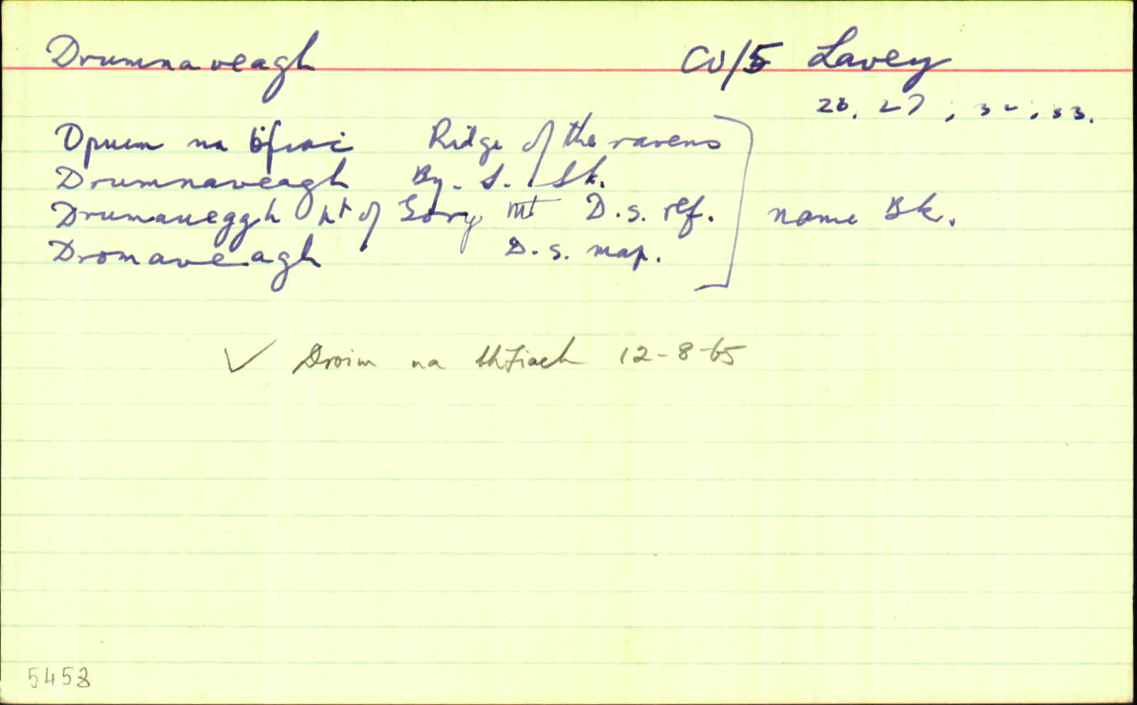
Drumnaveagh
(English)
Hierarchy
county
barony
civil parish
Explanatory note
- English
the ridge of the ravens
Centrepoint
53.9282, -7.17079latitude, longitude
Irish Grid (with letter)
Computing...
Irish Grid (without letter)
Computing...
Irish Transverse Mercator (ITM)
Computing...
Archival records
Historical references
| 1652 |
Dromneveha, parcell of Mountaine
|
|
| 1655 |
Dromingveagh pt. of Gory mount.
|
|
| 1660c |
Drumaveagh pt. of Gory mt:
|
|
| 1700c |
Drumnavegh
|
|
| 1821 |
Drumnevegh
|
|
| 1836 |
Druma[u]eggh Pt of Gory
|
DS Ref.:AL Leathanach: Ca049,17
|
| 1836 |
Dromaveagh
|
DS Map:AL Leathanach: Ca049,17
|
| 1836 |
Druim na bfeĭch
|
pl:AL Leathanach: Ca049,17
|
| 1836 |
Dromneveh
|
Commonwealth Survey:AL Leathanach: Ca049,17
|
| 1836 |
Drumaveigh
|
BM:AL Leathanach: Ca049,17
|
| 1836 |
Drumnavea
|
Co. Rates 1835:AL Leathanach: Ca049,17
|
| 1836 |
Drumnavegh
["1834"];
|
TAB Leathanach: Ca049,17
|
| 1836 |
Drumnavegh
|
Local:AL Leathanach: Ca049,17
|
| 1836 |
Drumneveigh
|
Co. Table:AL Leathanach: Ca049,17
|
| 1836 |
Drumnavegh
|
Co. List 1790:AL Leathanach: Ca049,17
|
| 1836 |
Druim na bhfiach, 'ridge of the ravens'
|
OD:AL Leathanach: Ca049,17
|
| 1836 |
Drumnaveagh
|
OD:AL Leathanach: Ca049,17
|
| 1836 |
Drumnaveagh
|
BS:AL Leathanach: Ca049,17
|
Please note: Some of the documentation from the archives of the Placenames Branch is available here. It indicates the range of research contributions undertaken by the Branch on this placename over the years. It may not constitute a complete record, and evidence may not be sequenced on the basis of validity. It is on this basis that this material is made available to the public.
Archival and research material provided on this site may be used, subject to acknowledgement. Issues regarding republication or other permissions or copyright should be addressed to logainm@dcu.ie.