Hierarchy
county
barony
civil parish
townland
townland
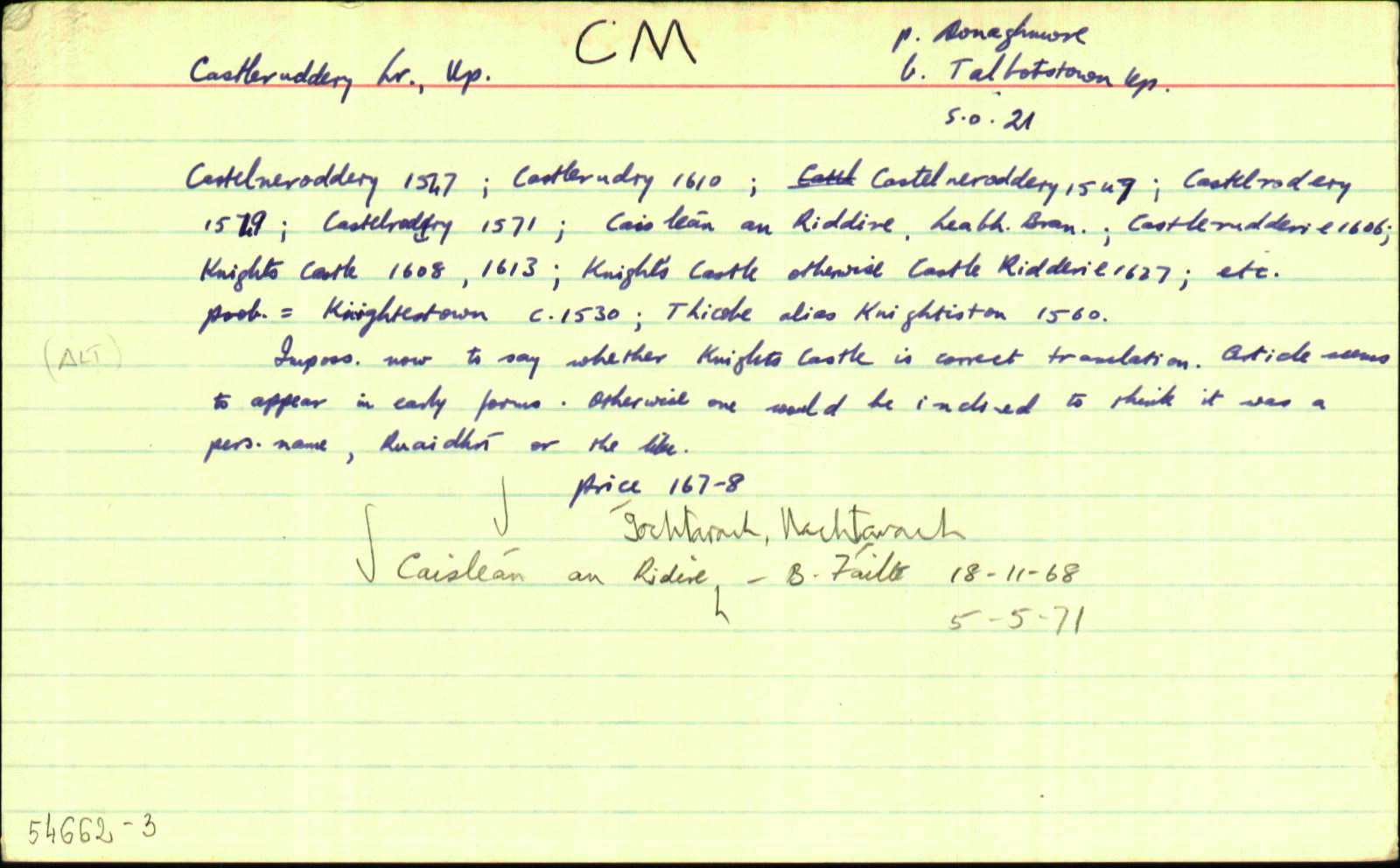
Caisleán an Ridire Uachtarach
genitive: Chaisleán an Ridire Uachtarach
(Irish)
Castleruddery Upper
(English)
Hierarchy
county
barony
civil parish
Centrepoint
52.9968, -6.63975latitude, longitude
Irish Grid (with letter)
Computing...
Irish Grid (without letter)
Computing...
Irish Transverse Mercator (ITM)
Computing...
Archival records
Historical references
| 1839 |
Castleruddery
|
Nevill Wicklow:AL Leathanach: CM032,5
|
| 1839 |
Castleruddery
|
Balwin Map:AL Leathanach: CM032,5
|
| 1839 |
Castleruddery
|
Cess Schedule:AL Leathanach: CM032,5
|
| 1839 |
Castleruddery
|
Registry of Co. Voters:AL (CM) Leathanach: CM032,5
|
| 1839 |
Castleruddery
|
GJP 1835:AL Leathanach: CM032,5
|
| 1839 |
Upper Castleruddery
|
BS:AL Leathanach: CM032,5
|
| 1839 |
Castleruddery &c
|
OC:AL Leathanach: CM032,5
|
| 1839 |
Castleruddery
|
TAB Leathanach: CM032,5
|
| 1839 |
Castleruddery
|
Radcliff, Rev. W.:AL Leathanach: CM032,5
|
| 1839 |
Castleruddery Upper
|
Greene, Rev. T.:AL Leathanach: CM032,5
|
| 1839 |
Upper Castleruddery (Townland)
|
Rec. Name:AL Leathanach: CM032,5
|
Please note: Some of the documentation from the archives of the Placenames Branch is available here. It indicates the range of research contributions undertaken by the Branch on this placename over the years. It may not constitute a complete record, and evidence may not be sequenced on the basis of validity. It is on this basis that this material is made available to the public.
Archival and research material provided on this site may be used, subject to acknowledgement. Issues regarding republication or other permissions or copyright should be addressed to logainm@dcu.ie.