Hierarchy
county
barony
municipal district
civil parish
electoral division
townland
subunits
townland
An Charraig Rua
genitive: na Carraige Rua
(Irish)
Carrigroe
(English)
Hierarchy
county
barony
municipal district
civil parish
electoral division
Centrepoint
53.0644, -6.26626latitude, longitude
Irish Grid (with letter)
Computing...
Irish Grid (without letter)
Computing...
Irish Transverse Mercator (ITM)
Computing...
Archival records
Historical references
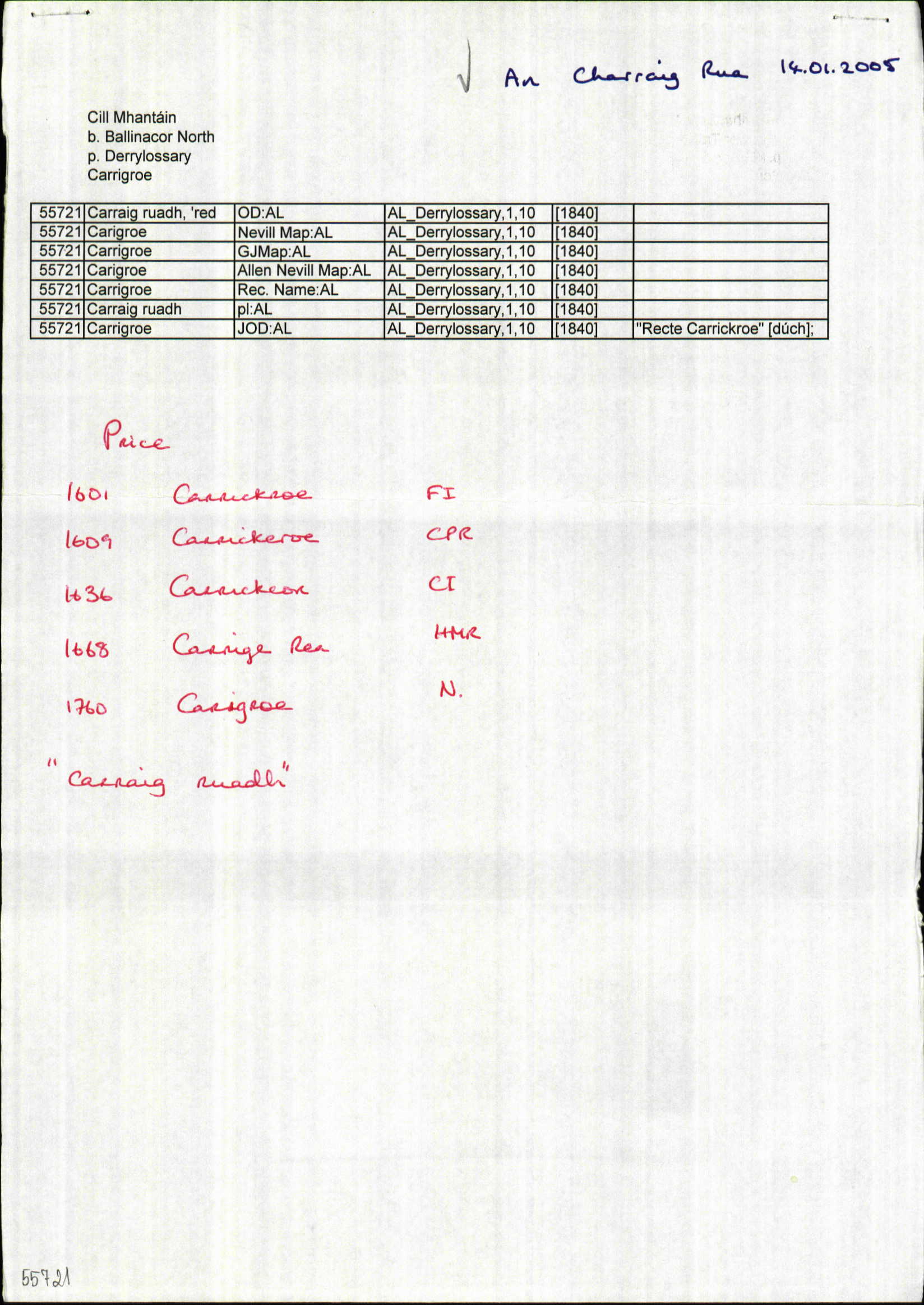
| 1601 |
Carrickroe
|
|
| 1609 |
Carrickeroe
|
|
| 1636 |
Carrickcor
|
|
| 1641 |
Carrogrowe
|
|
| 1641 |
Carregroe
|
|
| 1668 |
Carrige Rea
|
|
| 1711 |
Carrickrow,
|
|
| 1760 |
Carigroe
|
|
| 1828 |
Cearrickcrow als. Carrickcrow ows. Togher
|
|
| 1838 |
Carraig ruadh, 'red rock'
|
OD:AL Leathanach: CM028,10
|
| 1838 |
Carigroe
|
Nevill Wicklow:AL Leathanach: CM028,10
|
| 1838 |
Carraig ruadh
|
pl:AL Leathanach: CM028,10
|
| 1838 |
Carrigroe
"Recte Carrickroe" [dúch];
|
OD:AL Leathanach: CM028,10
|
| 1838 |
Carrigroe
|
CM:AL Leathanach: CM028,10
|
| 1838 |
Carigroe
|
Allen Nevill Map:AL (CM) Leathanach: CM028,10
|
| 1838 |
Carrigroe (Townland)
|
Rec. Name:AL Leathanach: CM028,10
|
Please note: Some of the documentation from the archives of the Placenames Branch is available here. It indicates the range of research contributions undertaken by the Branch on this placename over the years. It may not constitute a complete record, and evidence may not be sequenced on the basis of validity. It is on this basis that this material is made available to the public.
Archival and research material provided on this site may be used, subject to acknowledgement. Issues regarding republication or other permissions or copyright should be addressed to logainm@dcu.ie.