Hierarchy
county
barony
civil parish
townland
townland
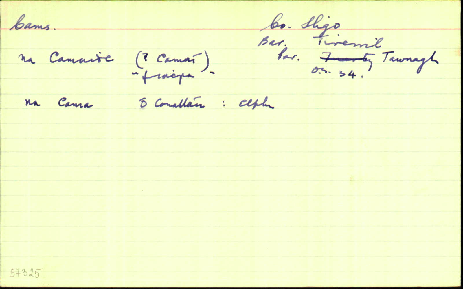
Cams
(English)
Centrepoint
54.0973, -8.42229latitude, longitude
Irish Grid (with letter)
Computing...
Irish Grid (without letter)
Computing...
Irish Transverse Mercator (ITM)
Computing...
Archival records
Historical references
| 1617 |
Carrowentample and Knockrawernagam
|
|
| 1655–7 |
The 2 qr. of Chanals. Carrowgam and Carrowtemple
|
|
| 1660c |
Carrownagon [leg. Carrownagom]
|
|
| 1665c |
Cama
|
|
| 1685c |
Carogam
|
|
| 1749 |
Cams
|
|
| 1758 |
Camms
|
|
| 1819 |
Cams
|
|
| 1824 |
Cambs
|
|
| 1836 |
Cams
|
BS:AL Leathanach: Sl047,4
|
| 1836 |
Cams
|
Larkin Map:AL Leathanach: Sl047,4
|
| 1836 |
na Cama, 'the windings'
|
OD:AL Leathanach: Sl047,4
|
| 1836 |
Cams
|
OD:AL Leathanach: Sl047,4
|
| 1836 |
[Cams]
"there are four ancient forts in this townland. The most southern is called Lisahullioin Fort on which stands a trigonometrical station (called Cams) ... another in the S.W. side called Partenalough Fort. Another in the N. side called Tawnageehy Fort. Also two springs, one called Tubber na Gollagh, the other Tubber [.......]" [Desc. Rem.];
|
Desc. Rem.:AL Leathanach: Sl047,4
|
| 1836 |
Cams
|
|
| 1938 |
Na Cama
|
Please note: Some of the documentation from the archives of the Placenames Branch is available here. It indicates the range of research contributions undertaken by the Branch on this placename over the years. It may not constitute a complete record, and evidence may not be sequenced on the basis of validity. It is on this basis that this material is made available to the public.
Archival and research material provided on this site may be used, subject to acknowledgement. Issues regarding republication or other permissions or copyright should be addressed to logainm@dcu.ie.