Hierarchy
county
barony
civil parish
townland
townland
Cappanaloha East
(English)
Centrepoint
51.6694, -9.47645latitude, longitude
Irish Grid (with letter)
Computing...
Irish Grid (without letter)
Computing...
Irish Transverse Mercator (ITM)
Computing...
Archival records
Historical references
| 1789 |
Cappanaloha
|
Bantry Papers Leathanach: 3, 777
|
| 1791 |
Cappanaloha
|
CGn. Leathanach: 431.143.279590
|
| 1796 |
Cappanalogy
|
Cl. Par. Rec. CCR Leathanach: 1, 166
|
| 1829 |
Capanaloha
|
TAB Leathanach: 7
|
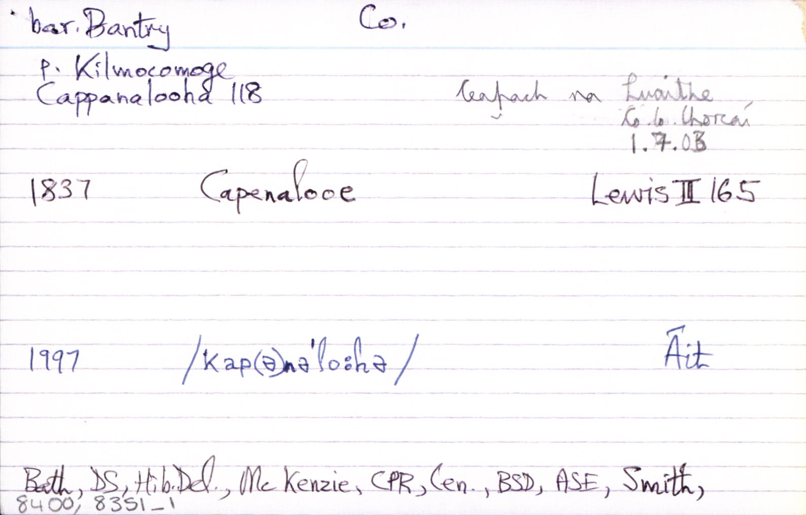
| 1837 |
Capenalooe
|
Top. Dict. Leathanach: ii, 165
|
| 1837 |
Cappanalohy
|
CGn. Leathanach: 13.86.330
|
| 1841 |
Capanaloha East
|
BS:AL Leathanach: Co243,35
|
| 1841 |
Capanaloha East
|
Young, J.:AL Leathanach: Co243,35
|
| 1841y |
Ceapach na loiche, 'plot of the lake'
|
OD:AL Leathanach: Co243,35
|
| 1841x |
Ceapa an locháin
|
pl:AL Leathanach: Co243,35
|
| 1841 |
Cappanaloha etc.
|
OD:AL Leathanach: Co243,35
|
| 1841 |
[Cappanaloha East]
"…in its southern extremity is a group of mud houses east of which stands an old Danish fort."
|
Desc. Rem.:AL Leathanach: Co243,35
|
Please note: Some of the documentation from the archives of the Placenames Branch is available here. It indicates the range of research contributions undertaken by the Branch on this placename over the years. It may not constitute a complete record, and evidence may not be sequenced on the basis of validity. It is on this basis that this material is made available to the public.
Archival and research material provided on this site may be used, subject to acknowledgement. Issues regarding republication or other permissions or copyright should be addressed to logainm@dcu.ie.