Hierarchy
county
barony
civil parish
population centre
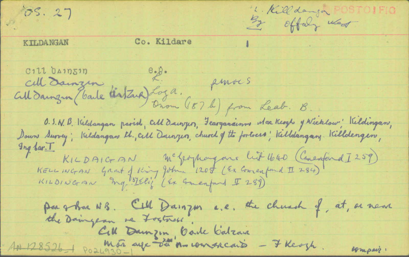
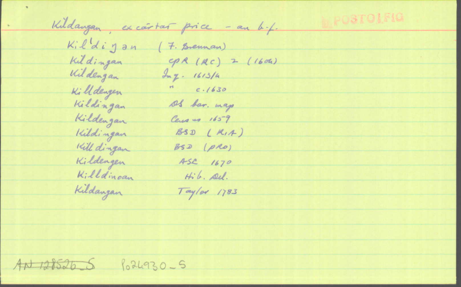
Kildangan
(English)
Hierarchy
county
barony
civil parish
Centrepoint
53.1056, -7.01241latitude, longitude
Irish Grid (with letter)
Computing...
Irish Grid (without letter)
Computing...
Irish Transverse Mercator (ITM)
Computing...
Properties
POThere is or was once a post office here
Archival records
Historical references
| 1629-44 |
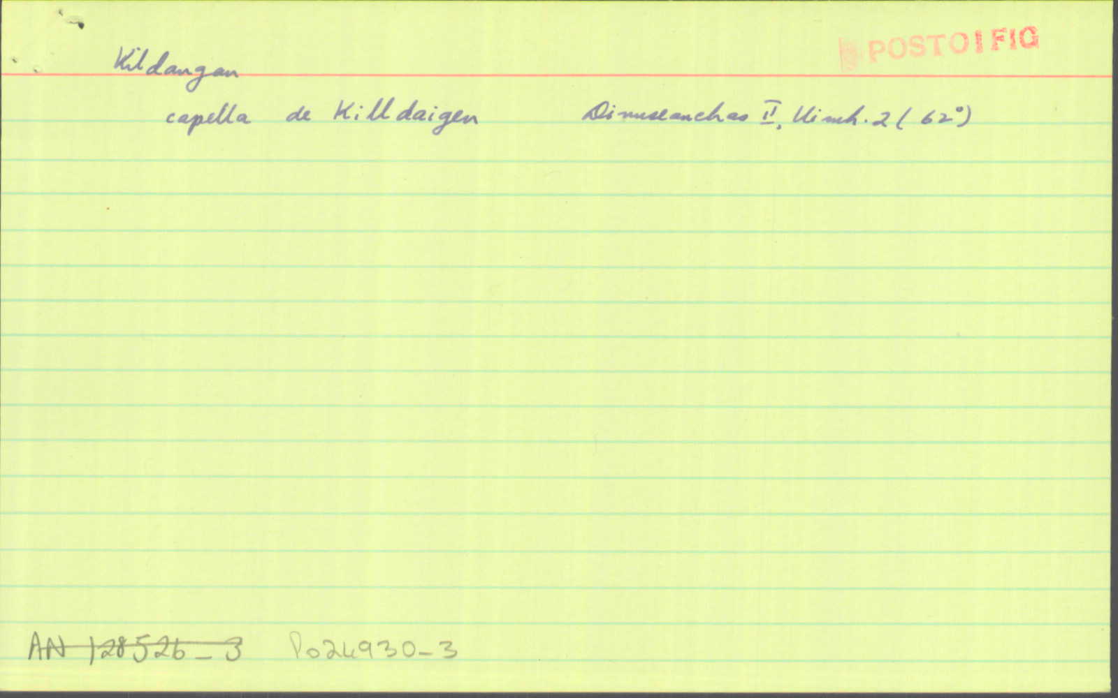
capella de Killdaigen
|
Cillsheanchas Chill Dara Leathanach: 2.31
|
| 1752 |
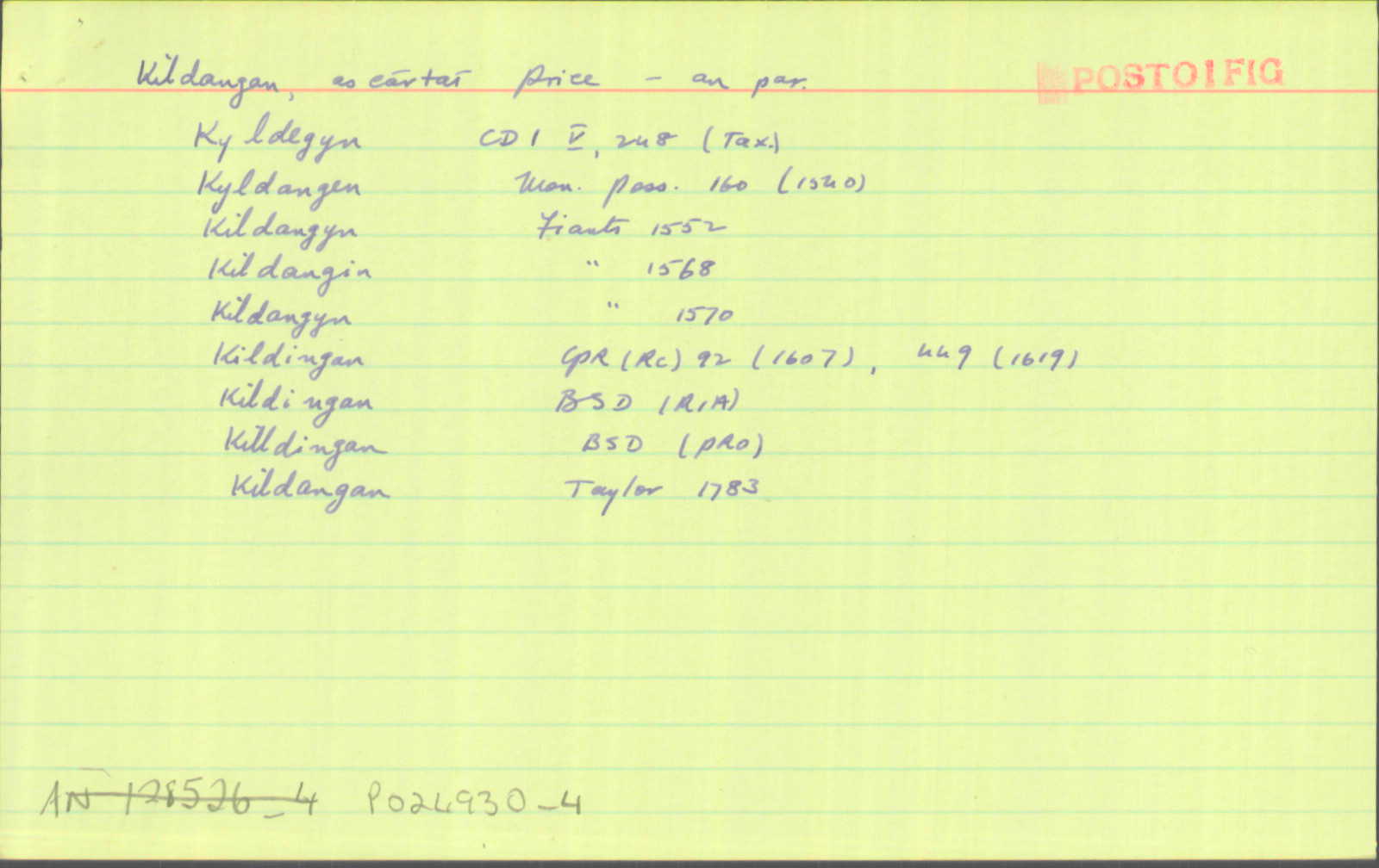
Killdangan
|
|
| 1807 |
Kildangan
|
Stat. Surv. (CD) Leathanach: 218
|
| 1837 |
[Kildangan]
"…a pond called Thubbertige…"
|
|
| 1837 |
Kildangan
|
|
| 1837 |
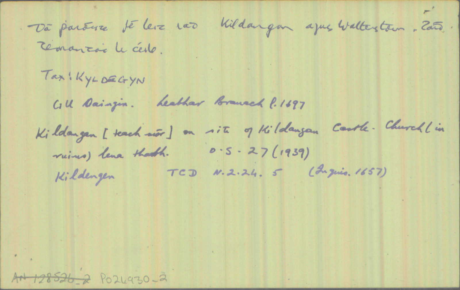
Cill daingin, 'church of the fortress'
|
|
| 1837 |
Killdangan; Killdengen
|
|
| 1837 |
Kildangan
[Harvey]
|
|
| 1837 |
Kildangan
|
|
| 1837 |
Kildangan
|
|
| 1837 |
Kildangan
|
|
| 1837 |
the Church of Kildangan having become delapidated
|
Top. Dict. Imleabhar: II, Leathanach: 674
|
Please note: Some of the documentation from the archives of the Placenames Branch is available here. It indicates the range of research contributions undertaken by the Branch on this placename over the years. It may not constitute a complete record, and evidence may not be sequenced on the basis of validity. It is on this basis that this material is made available to the public.
Archival and research material provided on this site may be used, subject to acknowledgement. Issues regarding republication or other permissions or copyright should be addressed to logainm@dcu.ie.
Permanent link
https://www.logainm.ie/1412374.aspxFurther information about this place
Folklore
The National Folklore Collection (dúchas.ie) contains material related to this place: