Hierarchy
county
barony
civil parish
townland
man-made feature
Hierarchy
county
barony
civil parish
townland
Explanatory note
- English
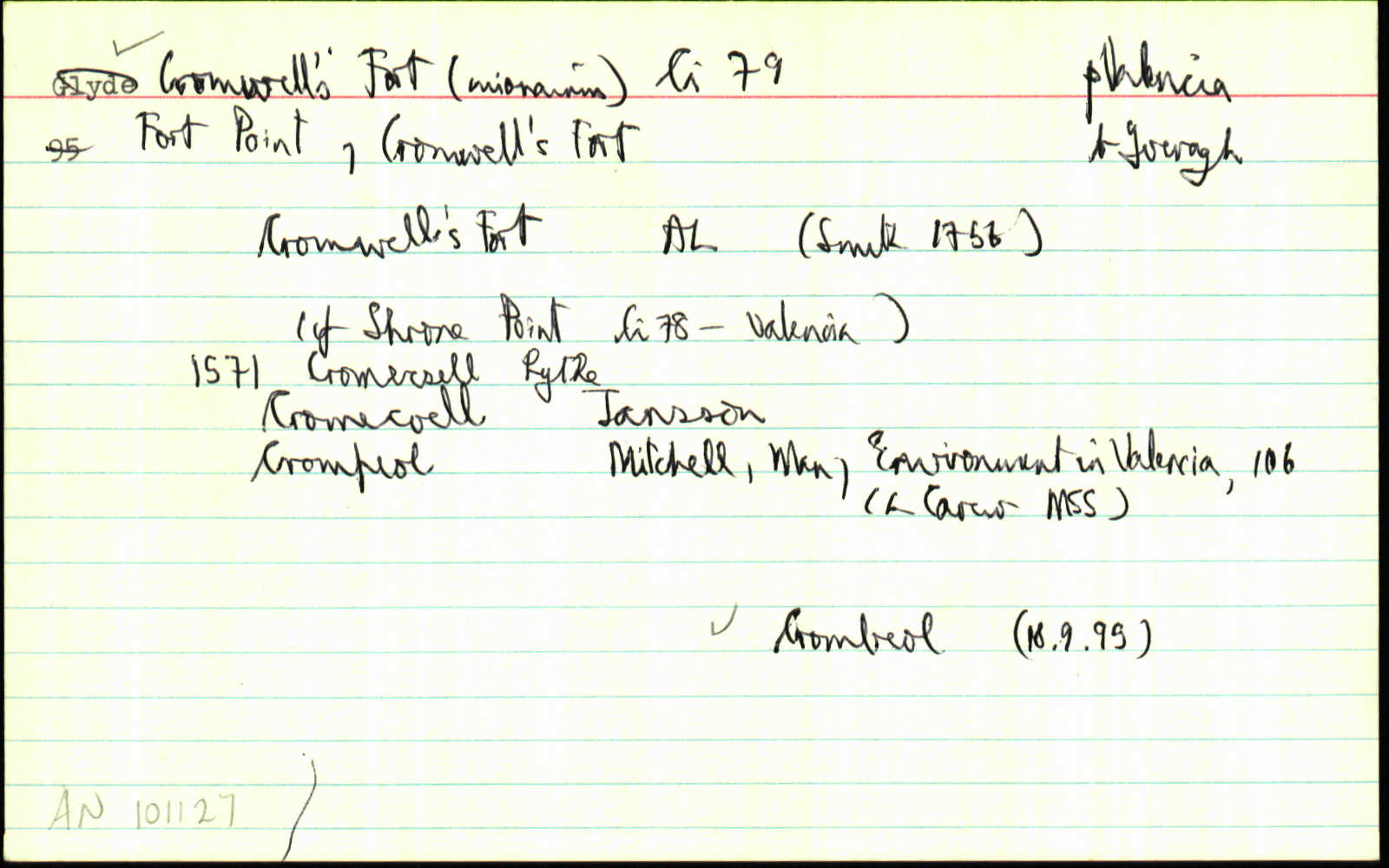
'Crompeol could conceivably be the plough-using farm ... on the eastern end of the Bray South Slope, as the name lies in its immediate vicinity. Later in the 17th century the name in the form of Crimphole is attached to the star-shaped fort which was built at t he westermn end of the Dysert Slope in 1653.' Man & Environment in Valencia Island 106
Centrepoint
Archival records
Historical references
| 1571 |
Cromecsell
|
|
| 1598 |
Crompeol
lsc.
|
Clancarthy Surv. Leathanach: 7
|
| 1655c |
fort
|
|
| 1660c |
'a fort at the south point of Corrabeg'
|
BSD (Ci) Leathanach: 22
|
| 1756 |
Cromwells Fort
|
Please note: Some of the documentation from the archives of the Placenames Branch is available here. It indicates the range of research contributions undertaken by the Branch on this placename over the years. It may not constitute a complete record, and evidence may not be sequenced on the basis of validity. It is on this basis that this material is made available to the public.
Archival and research material provided on this site may be used, subject to acknowledgement. Issues regarding republication or other permissions or copyright should be addressed to logainm@dcu.ie.