Hierarchy
county
barony
civil parish
townland, island or archipelago
townland, island or archipelago
Caher Island
(English)
Centrepoint
53.7169, -10.0305latitude, longitude
Irish Grid (with letter)
Computing...
Irish Grid (without letter)
Computing...
Irish Transverse Mercator (ITM)
Computing...
Archival records
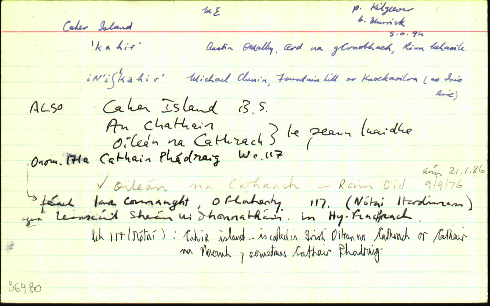
Historical references
| 1450 |
(?)Illa Sca
|
Westropp (Italian Maps) Leathanach: 413
|
| 1546 |
(?)ye Sa
|
Westropp (Italian Maps) Leathanach: 413
|
| 1569 |
(?)y santa
|
Westropp (Italian Maps) Leathanach: 413
|
| 1584 |
Caifre
|
|
| 1593 |
Caher
|
CSPI Leathanach: 133
|
| 1610c |
Cayhir
|
|
| 1635 |
the townlands of Dwoghmore contained 4 qrs whereof the islandsof Inistinrick and Iniscaher is 1 qr
|
Straff. Inq. ME Leathanach: §52
|
| 1661 |
(?)Roheran Iland 1 Cart
|
BSD (ME) Leathanach: 113
|
| 1672c |
Cagher
|
|
| 1691 |
Cahor
|
|
| 1715c |
Caher
|
|
| 1721 |
Kahir
|
|
| 1759c |
Caher
|
|
| 1776 |
Cahir
|
Mackenzie Leathanach: xiv
|
| 1792 |
Cahir I
|
|
| 1795c |
Cahir I.
|
|
| 1802 |
Cahir I.
|
|
| 1811 |
Cahir I
|
|
| 1812 |
Cahir
|
|
| 1830 |
Cahir
|
Bald Uimhir: 17
|
| 1838 |
Caher Island
|
BS:AL Leathanach: ME091,20
|
| 1838 |
Cahir
|
CM:AL Leathanach: ME091,20
|
| 1838 |
Cahir
|
HCSV:AL Leathanach: ME091,20
|
| 1838 |
Caher
|
TAB Leathanach: ME091,20
|
| 1838 |
Caher o níllan, 'fort island'
|
Giblin, P.:AL Leathanach: ME091,20
|
| 1838 |
Caher Island
|
Rent Office:AL (ME) Leathanach: ME091,20
|
| 1838 |
An cathair, oileán na cathrach, cathair na naomh 'and' cathair saoruigh, 'the stone fort, island of the caher etc.'
|
OD:AL Leathanach: ME091,20
|
| 1838 |
An chathair, oileán na cathrach
|
pl:AL Leathanach: ME091,20
|
| 1838 |
Caher Island
|
OD:AL Leathanach: ME091,20
|
| 1838 |
[Caher Island]
"…the ruins of an old chapel, 1 lake called 'Lough-kan-keel'."
|
Desc. Rem.:AL Leathanach: ME091,20
|
| 1910 |
Cathair Phádraig
|
MacNeill (ÓM) Leathanach: 130 §320
|
Please note: Some of the documentation from the archives of the Placenames Branch is available here. It indicates the range of research contributions undertaken by the Branch on this placename over the years. It may not constitute a complete record, and evidence may not be sequenced on the basis of validity. It is on this basis that this material is made available to the public.
Archival and research material provided on this site may be used, subject to acknowledgement. Issues regarding republication or other permissions or copyright should be addressed to logainm@dcu.ie.
Permanent link
https://www.logainm.ie/36980.aspxFolklore
The National Folklore Collection (dúchas.ie) contains material related to this place: